
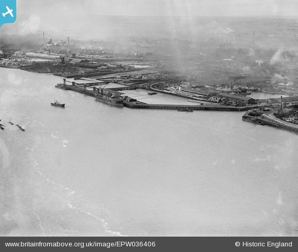
EPW036406 ENGLAND (1931). The West Wharf and the entrance to Alexandra Dock, Kingston upon Hull, from the south-east, 1931
© Copyright OpenStreetMap contributors and licensed by the OpenStreetMap Foundation. 2024. Cartography is licensed as CC BY-SA.
Nearby Images (6)
EPW036406

EAW004507

EPW036379

EAW046142

EPW036427

EAW324975

Details
| Title | [EPW036406] The West Wharf and the entrance to Alexandra Dock, Kingston upon Hull, from the south-east, 1931 |
| Reference | EPW036406 |
| Date | August-1931 |
| Link | |
| Place name | KINGSTON UPON HULL |
| Parish | |
| District | |
| Country | ENGLAND |
| Easting / Northing | 512442, 428497 |
| Longitude / Latitude | -0.29497118089142, 53.740491020724 |
| National Grid Reference | TA124285 |
Pins
Be the first to add a comment to this image!


