
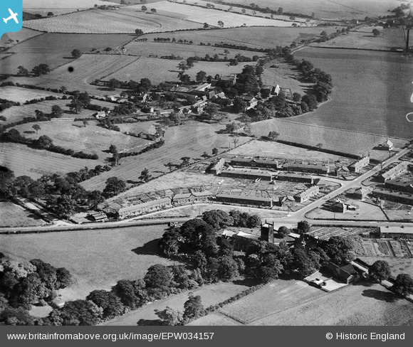
EPW034157 ENGLAND (1930). St Mary's Church and Church Crescent, Swillington, 1930
© Copyright OpenStreetMap contributors and licensed by the OpenStreetMap Foundation. 2025. Cartography is licensed as CC BY-SA.
Nearby Images (5)
EPW034157

EPW034154

EPW034156

EPW034155

EPW034158

Details
| Title | [EPW034157] St Mary's Church and Church Crescent, Swillington, 1930 |
| Reference | EPW034157 |
| Date | July-1930 |
| Link | |
| Place name | SWILLINGTON |
| Parish | SWILLINGTON |
| District | |
| Country | ENGLAND |
| Easting / Northing | 438646, 430371 |
| Longitude / Latitude | -1.4136257994934, 53.768030919447 |
| National Grid Reference | SE386304 |
Pins
 Helen |
Thursday 7th of December 2023 11:30:50 PM | |
 Class31 |
Sunday 8th of September 2013 08:26:30 AM | |
Class31 |
Sunday 8th of September 2013 08:25:54 AM | |
Class31 |
Sunday 8th of September 2013 08:25:11 AM | |
Class31 |
Sunday 8th of September 2013 08:24:22 AM | |
Class31 |
Sunday 8th of September 2013 08:15:14 AM | |
Class31 |
Sunday 8th of September 2013 08:09:00 AM | |
Class31 |
Sunday 8th of September 2013 08:06:39 AM |