
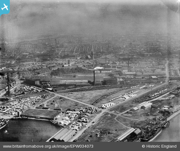
EPW034073 ENGLAND (1930). Marsh Lane Road and the English Electric Works, Preston, from the west, 1930
© Copyright OpenStreetMap contributors and licensed by the OpenStreetMap Foundation. 2024. Cartography is licensed as CC BY-SA.
Nearby Images (4)
EPW034073

EPW034074

EPW038884

EPW034075

Details
| Title | [EPW034073] Marsh Lane Road and the English Electric Works, Preston, from the west, 1930 |
| Reference | EPW034073 |
| Date | July-1930 |
| Link | |
| Place name | PRESTON |
| Parish | |
| District | |
| Country | ENGLAND |
| Easting / Northing | 352312, 429600 |
| Longitude / Latitude | -2.7234380663089, 53.760351461674 |
| National Grid Reference | SD523296 |
Pins
 Robert - Cumbria |
Thursday 6th of February 2014 12:45:05 AM | |
Robert - Cumbria |
Thursday 6th of February 2014 12:41:41 AM | |
Robert - Cumbria |
Thursday 6th of February 2014 12:40:47 AM | |
Robert - Cumbria |
Thursday 6th of February 2014 12:38:33 AM | |
 Class31 |
Tuesday 8th of January 2013 10:27:56 PM | |
Class31 |
Tuesday 8th of January 2013 10:26:55 PM | |
Class31 |
Tuesday 8th of January 2013 10:26:19 PM |
User Comment Contributions
 St. Walburge's Church, Preston, 15/06/2013 |
Class31 |
Monday 14th of September 2015 08:20:45 PM |


