
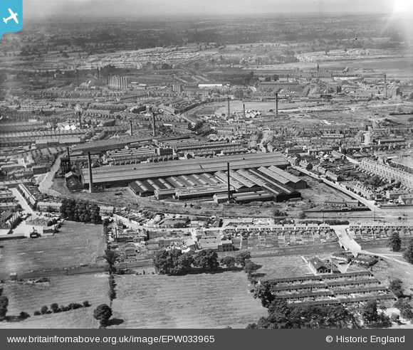
EPW033965 ENGLAND (1930). The English Electric Co Works, Coventry, 1930
© Copyright OpenStreetMap contributors and licensed by the OpenStreetMap Foundation. 2024. Cartography is licensed as CC BY-SA.
Nearby Images (12)
EPW033965

EPW001193

EPW033956

EPW010520

EPW033959

EPW010519

EPW033958

EPW061097

EPW033964

EPW061217

EPW010518

EPW033957

Details
| Title | [EPW033965] The English Electric Co Works, Coventry, 1930 |
| Reference | EPW033965 |
| Date | July-1930 |
| Link | |
| Place name | COVENTRY |
| Parish | |
| District | |
| Country | ENGLAND |
| Easting / Northing | 434650, 280276 |
| Longitude / Latitude | -1.4904485519137, 52.419001645391 |
| National Grid Reference | SP347803 |
Pins
 PeteW |
Wednesday 26th of January 2022 03:21:17 PM | |
PeteW |
Wednesday 26th of January 2022 03:19:51 PM | |
PeteW |
Wednesday 26th of January 2022 03:18:58 PM | |
John W |
Sunday 17th of July 2016 08:52:50 PM | |
John W |
Sunday 17th of July 2016 08:52:05 PM | |
John W |
Sunday 17th of July 2016 08:50:33 PM | |
Bob Curtis |
Saturday 2nd of April 2016 11:56:17 AM | |
Bob Curtis |
Friday 1st of April 2016 11:47:56 AM | |
Bob Curtis |
Friday 1st of April 2016 11:47:14 AM | |
Bob Curtis |
Friday 1st of April 2016 11:09:09 AM |
User Comment Contributions
 Because of the occupation of the Ordnance Works by the Admiralty from 1938 this area suffered badly from the bombing |
Bob Curtis |
Monday 4th of April 2016 10:57:20 AM |