
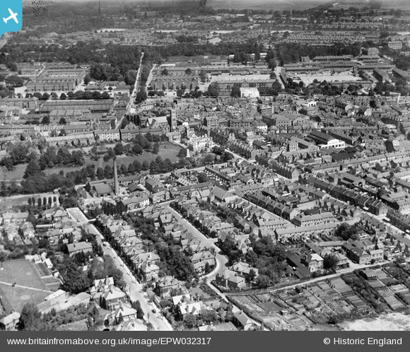
EPW032317 ENGLAND (1930). The town centre, Aldershot, from the south, 1930
© Copyright OpenStreetMap contributors and licensed by the OpenStreetMap Foundation. 2024. Cartography is licensed as CC BY-SA.
Nearby Images (2)
EPW032317

EPW056802

Details
| Title | [EPW032317] The town centre, Aldershot, from the south, 1930 |
| Reference | EPW032317 |
| Date | 5-June-1930 |
| Link | |
| Place name | ALDERSHOT |
| Parish | |
| District | |
| Country | ENGLAND |
| Easting / Northing | 486122, 150336 |
| Longitude / Latitude | -0.76600637764025, 51.245175656578 |
| National Grid Reference | SU861503 |
Pins
 David960 |
Sunday 1st of February 2015 03:05:39 PM | |
David960 |
Sunday 1st of February 2015 03:05:02 PM | |
David960 |
Sunday 1st of February 2015 03:04:49 PM | |
David960 |
Sunday 1st of February 2015 03:04:28 PM | |
David960 |
Sunday 1st of February 2015 03:02:50 PM | |
David960 |
Sunday 1st of February 2015 03:02:00 PM | |
David960 |
Sunday 1st of February 2015 03:01:43 PM | |
David960 |
Sunday 1st of February 2015 03:00:45 PM | |
FrancesO |
Sunday 2nd of February 2014 01:34:29 AM |


