
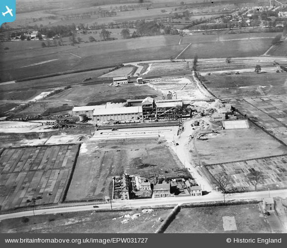
EPW031727 ENGLAND (1930). The Central Sugar Co Sugar Beet Factory, Peterborough, 1930
© Copyright OpenStreetMap contributors and licensed by the OpenStreetMap Foundation. 2024. Cartography is licensed as CC BY-SA.
Nearby Images (8)
EPW031727

EPW031732

EPW031728

EPW031730

EPW031731

EPW031729

EPW031726

EPW031725

Details
| Title | [EPW031727] The Central Sugar Co Sugar Beet Factory, Peterborough, 1930 |
| Reference | EPW031727 |
| Date | April-1930 |
| Link | |
| Place name | PETERBOROUGH |
| Parish | |
| District | |
| Country | ENGLAND |
| Easting / Northing | 517807, 297669 |
| Longitude / Latitude | -0.26180957699106, 52.563720748315 |
| National Grid Reference | TL178977 |
Pins
 Grimsby Boy |
Wednesday 24th of December 2014 06:10:50 PM | |
Grimsby Boy |
Wednesday 24th of December 2014 06:09:21 PM | |
 Richard Humphrey |
Saturday 23rd of March 2013 11:05:59 PM |


