
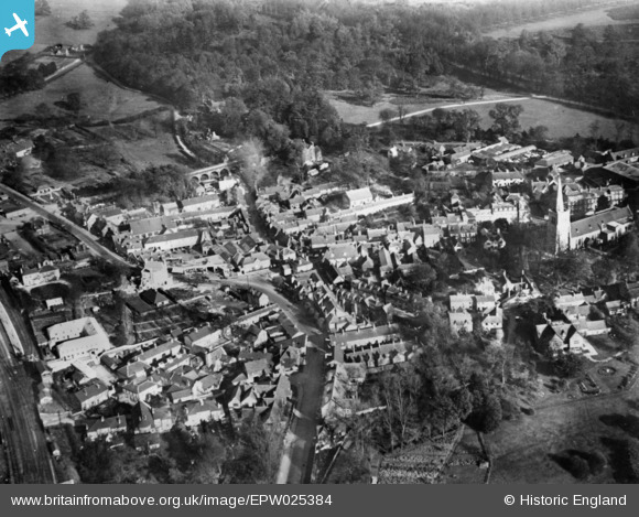
EPW025384 ENGLAND (1928). London Road and environs, Hatfield, 1928. This image has been produced from a copy-negative.
© Copyright OpenStreetMap contributors and licensed by the OpenStreetMap Foundation. 2024. Cartography is licensed as CC BY-SA.
Nearby Images (15)
EPW025384

EPW061270

EPW005054

EAW053003

EPW025489

EPW025380

EAW053193

EAW049354

EAW049361

EAW053191

EAW053190

EAW042108

EAW050563

EAW042107

EPW025382

Details
| Title | [EPW025384] London Road and environs, Hatfield, 1928. This image has been produced from a copy-negative. |
| Reference | EPW025384 |
| Date | November-1928 |
| Link | |
| Place name | HATFIELD |
| Parish | HATFIELD |
| District | |
| Country | ENGLAND |
| Easting / Northing | 523398, 208591 |
| Longitude / Latitude | -0.21174946836207, 51.761934660777 |
| National Grid Reference | TL234086 |
Pins
 John W |
Thursday 23rd of June 2016 09:43:04 PM |


