
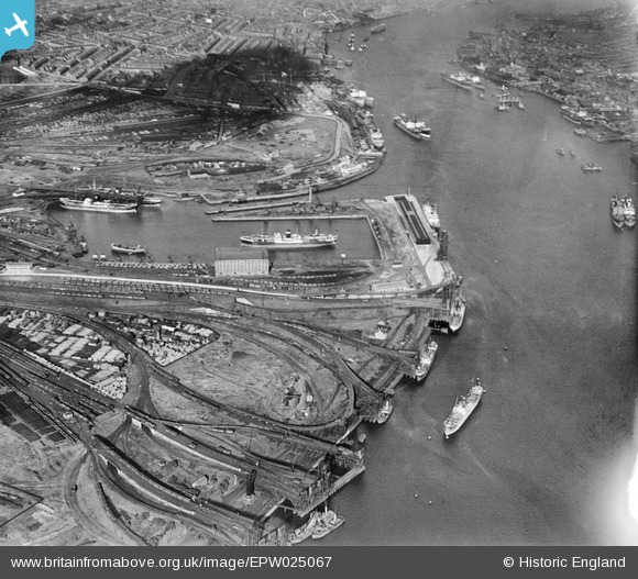
EPW025067 ENGLAND (1928). The Albert Edward Dock and the Timber Yards, Royal Quays, 1928
© Copyright OpenStreetMap contributors and licensed by the OpenStreetMap Foundation. 2024. Cartography is licensed as CC BY-SA.
Nearby Images (10)
EPW025067

EPW025066

EPW019845

EPW019797

EPW025057

EPW025063

EPW025069

EPW025070

EPW025061

EPW025062

Details
| Title | [EPW025067] The Albert Edward Dock and the Timber Yards, Royal Quays, 1928 |
| Reference | EPW025067 |
| Date | 14-October-1928 |
| Link | |
| Place name | ROYAL QUAYS |
| Parish | |
| District | |
| Country | ENGLAND |
| Easting / Northing | 435213, 566726 |
| Longitude / Latitude | -1.4495550007727, 54.993797354435 |
| National Grid Reference | NZ352667 |
Pins
Be the first to add a comment to this image!


