
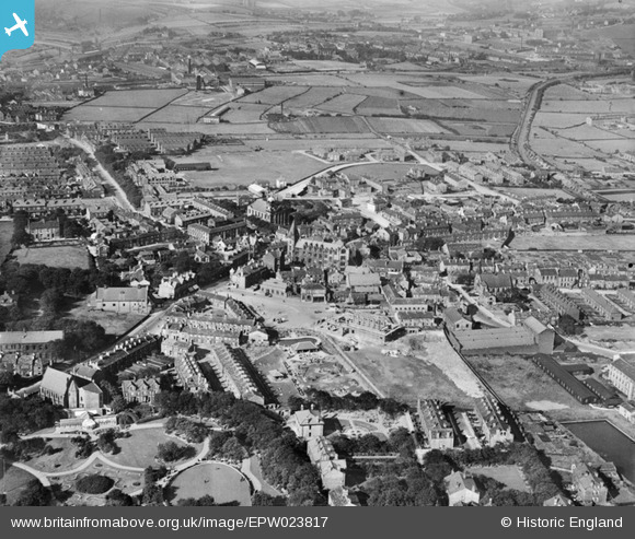
EPW023817 ENGLAND (1928). The town centre including the swimming baths under construction, Pudsey, 1928
© Copyright OpenStreetMap contributors and licensed by the OpenStreetMap Foundation. 2024. Cartography is licensed as CC BY-SA.
Nearby Images (5)
EPW023817

EPW023815

EPW034278

EPW034280

EPW034284

Details
| Title | [EPW023817] The town centre including the swimming baths under construction, Pudsey, 1928 |
| Reference | EPW023817 |
| Date | September-1928 |
| Link | |
| Place name | PUDSEY |
| Parish | |
| District | |
| Country | ENGLAND |
| Easting / Northing | 422336, 433415 |
| Longitude / Latitude | -1.6608697089636, 53.796347979214 |
| National Grid Reference | SE223334 |
Pins
 James |
Tuesday 21st of June 2022 07:59:11 AM | |
James |
Tuesday 21st of June 2022 07:58:56 AM | |
James |
Wednesday 4th of May 2022 04:23:42 PM | |
gerry-r |
Wednesday 2nd of July 2014 09:46:48 PM | |
gerry-r |
Wednesday 2nd of July 2014 09:09:46 PM | |
gerry-r |
Wednesday 2nd of July 2014 08:55:44 PM | |
MeFairn |
Saturday 7th of July 2012 10:08:08 AM | |
There's certainly one there now, but sadly square. |
gerry-r |
Wednesday 2nd of July 2014 11:09:43 PM |
Mike Harrison |
Sunday 1st of July 2012 07:52:17 PM | |
Mike Harrison |
Sunday 1st of July 2012 07:51:41 PM | |
Mike Harrison |
Sunday 1st of July 2012 07:49:11 PM | |
tibbs |
Thursday 28th of June 2012 08:35:13 PM | |
Looks more like a children's playground than municipal park ? |
gerry-r |
Wednesday 2nd of July 2014 09:48:30 PM |
User Comment Contributions
actually the Children's Playground, the Park is to the lower left. |
Mike Harrison |
Sunday 1st of July 2012 07:48:40 PM |


