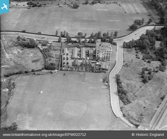
EPW022712 ENGLAND (1928). The Virol Factory and Sports Ground, Ealing, 1928
© Copyright OpenStreetMap contributors and licensed by the OpenStreetMap Foundation. 2024. Cartography is licensed as CC BY-SA.
Nearby Images (33)
EPW022712

EPW009226

EPW009228

EPW009225

EPW009230

EPW009229

EPW009231

EAW048757

EPW009222

EPW022713

EPW008079

EAW048738

EPW009227

EAW048741

EAW048742

EAW048739

EAW048745

EPW009224

EPW022714

EAW048743

EAW048751

EAW048752

EAW048746

EAW048753

EAW048755

EAW048747

EAW048748

EAW048749

EAW048750

EAW048740

EAW048754

EAW048744

EPW040772

Details
| Title | [EPW022712] The Virol Factory and Sports Ground, Ealing, 1928 |
| Reference | EPW022712 |
| Date | August-1928 |
| Link | |
| Place name | EALING |
| Parish | |
| District | |
| Country | ENGLAND |
| Easting / Northing | 518250, 182863 |
| Longitude / Latitude | -0.29501543627406, 51.531795296021 |
| National Grid Reference | TQ183829 |