
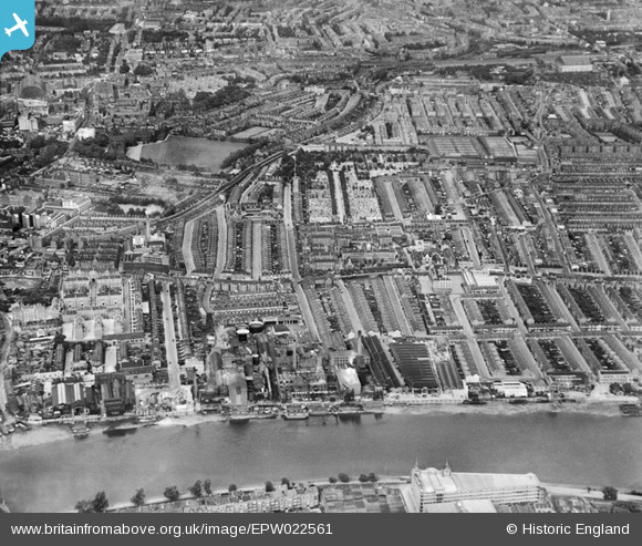
EPW022561 ENGLAND (1928). Fulham Palace Road and environs, Fulham, from the west, 1928
© Copyright OpenStreetMap contributors and licensed by the OpenStreetMap Foundation. 2024. Cartography is licensed as CC BY-SA.
Nearby Images (20)
EPW022561

EPW007981

EPW022556

EPW022559

EPW022554

EPW007947

EPW022805

EPW022558

EPW022799

EPW022802

EPW022801

EPW024775

EPW022803

EPW022804

EPW024774

EPW022800

EPW024773

EPW010782

EPW022555

EPW022557

Details
| Title | [EPW022561] Fulham Palace Road and environs, Fulham, from the west, 1928 |
| Reference | EPW022561 |
| Date | August-1928 |
| Link | |
| Place name | FULHAM |
| Parish | |
| District | |
| Country | ENGLAND |
| Easting / Northing | 523335, 177885 |
| Longitude / Latitude | -0.22347620509433, 51.485964121946 |
| National Grid Reference | TQ233779 |
Pins
 Mike H |
Saturday 25th of January 2014 08:35:44 PM | |
london_lighterman |
Thursday 10th of October 2013 11:51:57 PM |


