
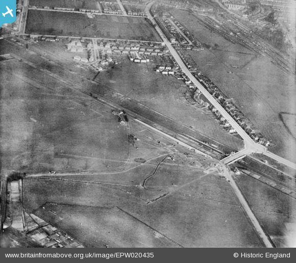
EPW020435 ENGLAND (1928). Housing development around Noel Road and the North Acton Playing Fields, Acton, 1928
© Copyright OpenStreetMap contributors and licensed by the OpenStreetMap Foundation. 2024. Cartography is licensed as CC BY-SA.
Nearby Images (13)
EPW020435

EPW020436

EPW020432

EPW020882

EPW020431

EPW037091

EPW037092

EPW020878

EPW037088

EPW037090

EPW047101

EPW037089

EPW021150

Details
| Title | [EPW020435] Housing development around Noel Road and the North Acton Playing Fields, Acton, 1928 |
| Reference | EPW020435 |
| Date | March-1928 |
| Link | |
| Place name | ACTON |
| Parish | |
| District | |
| Country | ENGLAND |
| Easting / Northing | 519454, 181442 |
| Longitude / Latitude | -0.27814593904693, 51.518769275749 |
| National Grid Reference | TQ195814 |


