
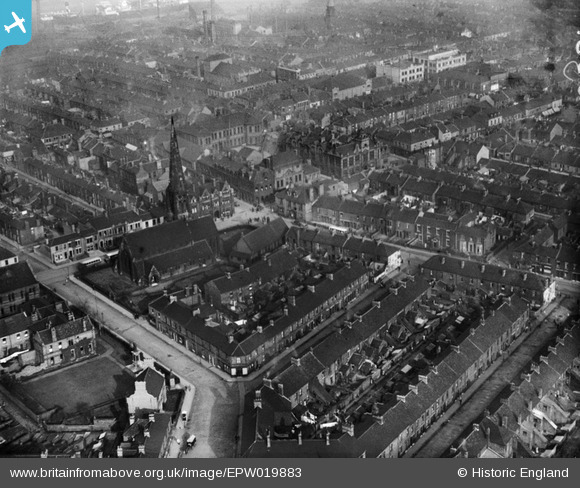
EPW019883 ENGLAND (1927). Christ Church and the town, Jarrow, 1927
© Copyright OpenStreetMap contributors and licensed by the OpenStreetMap Foundation. 2024. Cartography is licensed as CC BY-SA.
Nearby Images (5)
EPW019883

EPW019880

EPW019879

EPW019878

EPW019881

Details
| Title | [EPW019883] Christ Church and the town, Jarrow, 1927 |
| Reference | EPW019883 |
| Date | October-1927 |
| Link | |
| Place name | JARROW |
| Parish | |
| District | |
| Country | ENGLAND |
| Easting / Northing | 432667, 565272 |
| Longitude / Latitude | -1.4895177624538, 54.980903974383 |
| National Grid Reference | NZ327653 |
Pins
 N Dunn |
Wednesday 18th of March 2015 07:05:23 PM | |
N Dunn |
Wednesday 18th of March 2015 07:03:03 PM | |
N Dunn |
Wednesday 18th of March 2015 06:59:09 PM | |
 |
N Dunn |
Wednesday 18th of March 2015 06:58:35 PM |
 |
N Dunn |
Wednesday 18th of March 2015 06:56:00 PM |
 |
N Dunn |
Thursday 12th of September 2013 10:03:18 AM |
 |
N Dunn |
Thursday 12th of September 2013 09:59:09 AM |
 |
N Dunn |
Thursday 12th of September 2013 09:56:29 AM |
 |
N Dunn |
Thursday 12th of September 2013 09:54:29 AM |


