
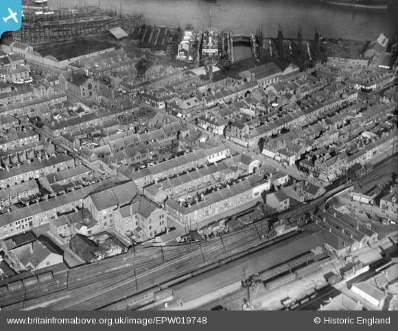
EPW019748 ENGLAND (1927). Regent Street and Shipbuilding Yards, Blyth, 1927
© Copyright OpenStreetMap contributors and licensed by the OpenStreetMap Foundation. 2025. Cartography is licensed as CC BY-SA.
Nearby Images (10)
EPW019748

EAW014445

EAW014455

EAW013063

EPW019752

EAW014453

EAW013064

EAW014454

EAW014447

EAW014446

Details
| Title | [EPW019748] Regent Street and Shipbuilding Yards, Blyth, 1927 |
| Reference | EPW019748 |
| Date | 18-October-1927 |
| Link | |
| Place name | BLYTH |
| Parish | BLYTH |
| District | |
| Country | ENGLAND |
| Easting / Northing | 431214, 581757 |
| Longitude / Latitude | -1.5104183163667, 55.129144708578 |
| National Grid Reference | NZ312818 |
Pins
 ANeilM |
Wednesday 21st of December 2016 09:51:27 PM | |
pursebearer |
Thursday 5th of March 2015 06:01:44 PM | |
pursebearer |
Thursday 5th of March 2015 05:58:40 PM | |
pursebearer |
Thursday 5th of March 2015 05:57:31 PM |
User Comment Contributions
A really useful shot for me as a modeller of the railway and its station. The station building and canopy covering both platforms can be seen in the bottom right corner. |
Blyth Station Lad |
Tuesday 26th of June 2012 09:36:06 AM |