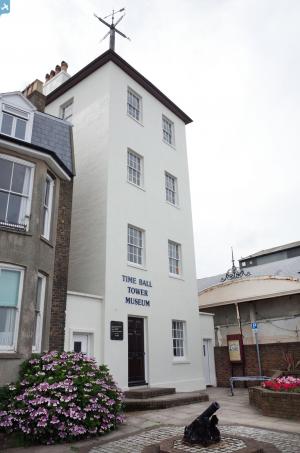
EPW019061 ENGLAND (1927). Beach Street and environs, Deal, 1927
© Copyright OpenStreetMap contributors and licensed by the OpenStreetMap Foundation. 2024. Cartography is licensed as CC BY-SA.
Nearby Images (12)
Details
| Title | [EPW019061] Beach Street and environs, Deal, 1927 |
| Reference | EPW019061 |
| Date | 3-August-1927 |
| Link | |
| Place name | DEAL |
| Parish | DEAL |
| District | |
| Country | ENGLAND |
| Easting / Northing | 637774, 152524 |
| Longitude / Latitude | 1.4055775499365, 51.221789746859 |
| National Grid Reference | TR378525 |
Pins
 Alan McFaden |
Wednesday 9th of July 2014 10:47:26 AM | |
 Alan McFaden |
Wednesday 9th of July 2014 10:47:04 AM | |
 Simon Cox |
Wednesday 27th of June 2012 02:16:58 PM |
User Comment Contributions
Fantastic ariel photos... |
 Bryan |
Friday 19th of October 2012 08:00:38 PM |


![[EPW019061] Beach Street and environs, Deal, 1927](http://britainfromabove.org.uk/sites/all/libraries/aerofilms-images/public/100x100/EPW/019/EPW019061.jpg)
![[EPW042831] Queen Street and environs, Deal, 1933](http://britainfromabove.org.uk/sites/all/libraries/aerofilms-images/public/100x100/EPW/042/EPW042831.jpg)
![[EPW039322] Beach Street and the pier, Deal, 1932](http://britainfromabove.org.uk/sites/all/libraries/aerofilms-images/public/100x100/EPW/039/EPW039322.jpg)
![[EPW009180] The pier and Prince of Wales Road area, Deal, 1923](http://britainfromabove.org.uk/sites/all/libraries/aerofilms-images/public/100x100/EPW/009/EPW009180.jpg)
![[EPW009179] The pier and Prince of Wales Road area, Deal, 1923](http://britainfromabove.org.uk/sites/all/libraries/aerofilms-images/public/100x100/EPW/009/EPW009179.jpg)
![[EPW009177] South Parade and environs, Deal, 1923](http://britainfromabove.org.uk/sites/all/libraries/aerofilms-images/public/100x100/EPW/009/EPW009177.jpg)
![[EPW035436] Beach Street, the Deal Promenade Pier and the town, Deal, 1931](http://britainfromabove.org.uk/sites/all/libraries/aerofilms-images/public/100x100/EPW/035/EPW035436.jpg)
![[EPW039320] The pier and South Parade, Deal, 1932](http://britainfromabove.org.uk/sites/all/libraries/aerofilms-images/public/100x100/EPW/039/EPW039320.jpg)
![[EPW000388] South Parade, Deal, 1920](http://britainfromabove.org.uk/sites/all/libraries/aerofilms-images/public/100x100/EPW/000/EPW000388.jpg)
![[EPW042832] The seafront, Deal, from the south-east, 1933. This image has been produced from a damaged negative.](http://britainfromabove.org.uk/sites/all/libraries/aerofilms-images/public/100x100/EPW/042/EPW042832.jpg)
![[EPW035437] The Deal Promenade Pier, the town and The Small Downs, Deal, from the south, 1931](http://britainfromabove.org.uk/sites/all/libraries/aerofilms-images/public/100x100/EPW/035/EPW035437.jpg)
![[EPW009178] The pier and promenade and environs, Deal, 1923](http://britainfromabove.org.uk/sites/all/libraries/aerofilms-images/public/100x100/EPW/009/EPW009178.jpg)

