
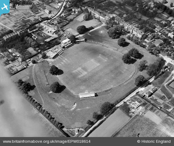
EPW018614 ENGLAND (1927). Cricket match in progress at the County Cricket Ground (St Lawrence Ground), Canterbury, 1927
© Copyright OpenStreetMap contributors and licensed by the OpenStreetMap Foundation. 2024. Cartography is licensed as CC BY-SA.
Nearby Images (13)
EPW018614
, Canterbury, 1927")
EPW018613
, Canterbury, 1927")
EPW018610
, Canterbury, 1927")
EAW031807

EPW038145

EAW014340
, Canterbury, from the south-east, 1948. This image has been produced from a print.")
EPW018611
, Canterbury, 1927")
EAW031806

EAW014339
, Canterbury, 1948. This image has been produced from a print.")
EAW014338
, Canterbury, 1948. This image has been produced from a print.")
EAW014337
, Canterbury, 1948. This image has been produced from a print.")
EAW031805

EAW014341
, Canterbury, from the north-east, 1948. This image has been produced from a print.")
Details
| Title | [EPW018614] Cricket match in progress at the County Cricket Ground (St Lawrence Ground), Canterbury, 1927 |
| Reference | EPW018614 |
| Date | 22-June-1927 |
| Link | |
| Place name | CANTERBURY |
| Parish | |
| District | |
| Country | ENGLAND |
| Easting / Northing | 615768, 156557 |
| Longitude / Latitude | 1.093339041223, 51.26674746594 |
| National Grid Reference | TR158566 |
Pins
 SH1955 |
Saturday 11th of August 2012 06:01:17 PM | |
SH1955 |
Saturday 11th of August 2012 05:59:13 PM | |
SH1955 |
Saturday 11th of August 2012 05:55:14 PM | |
SH1955 |
Saturday 11th of August 2012 05:54:36 PM | |
SH1955 |
Saturday 11th of August 2012 05:53:58 PM | |
SH1955 |
Saturday 11th of August 2012 05:53:16 PM | |
SH1955 |
Saturday 11th of August 2012 05:49:44 PM | |
SH1955 |
Saturday 11th of August 2012 05:44:31 PM | |
SH1955 |
Saturday 11th of August 2012 05:43:31 PM | |
SH1955 |
Saturday 11th of August 2012 05:34:48 PM |
User Comment Contributions
Given the apparent lack of a crowd I would judge that this is not a first class match. |
SH1955 |
Monday 18th of July 2016 08:32:28 AM |
Kent were playing Sussex at Horsham on this day in 1927. |
Kentishman |
Monday 18th of July 2016 08:32:28 AM |