
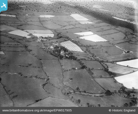
EPW017905 ENGLAND (1927). Countryside around Coley Brook and the village, Rushbury, from the west, 1927. This image has been produced from a damaged negative.
© Copyright OpenStreetMap contributors and licensed by the OpenStreetMap Foundation. 2025. Cartography is licensed as CC BY-SA.
Nearby Images (4)
EPW017905

EPW017906

EPW017893

EPW017896

Details
| Title | [EPW017905] Countryside around Coley Brook and the village, Rushbury, from the west, 1927. This image has been produced from a damaged negative. |
| Reference | EPW017905 |
| Date | 11-May-1927 |
| Link | |
| Place name | RUSHBURY |
| Parish | RUSHBURY |
| District | |
| Country | ENGLAND |
| Easting / Northing | 350939, 291633 |
| Longitude / Latitude | -2.7231307793741, 52.52000152678 |
| National Grid Reference | SO509916 |
Pins
User Comment Contributions
See also EPW017891 to EPW017905 (excluding EPW017903) |
 BigglesH |
Monday 23rd of July 2012 07:22:01 PM |
Looking East over Rushbury with Wenlock Edge to the right and showing the Rushbury Station on the Great Western Railway Craven Arms - Much Wenlock line. The tower of St. Peter's Parish Church in Rushbury can be seen through the trees. |
 Class31 |
Thursday 5th of July 2012 10:14:34 AM |