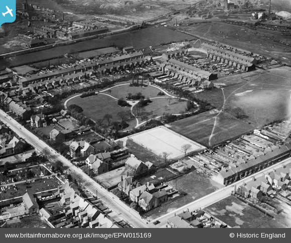
EPW015169 ENGLAND (1926). The Park and Recreation Ground, Coalville, 1926
© Copyright OpenStreetMap contributors and licensed by the OpenStreetMap Foundation. 2025. Cartography is licensed as CC BY-SA.
Details
| Title | [EPW015169] The Park and Recreation Ground, Coalville, 1926 |
| Reference | EPW015169 |
| Date | 13-April-1926 |
| Link | |
| Place name | COALVILLE |
| Parish | |
| District | |
| Country | ENGLAND |
| Easting / Northing | 443017, 314165 |
| Longitude / Latitude | -1.363013982474, 52.723080303381 |
| National Grid Reference | SK430142 |
Pins
 Class31 |
Tuesday 5th of May 2015 08:43:17 AM |


![[EPW015169] The Park and Recreation Ground, Coalville, 1926](http://britainfromabove.org.uk/sites/all/libraries/aerofilms-images/public/100x100/EPW/015/EPW015169.jpg)
![[EPW015167] London Road, Coalville, 1926. This image has been produced from a copy-negative.](http://britainfromabove.org.uk/sites/all/libraries/aerofilms-images/public/100x100/EPW/015/EPW015167.jpg)