
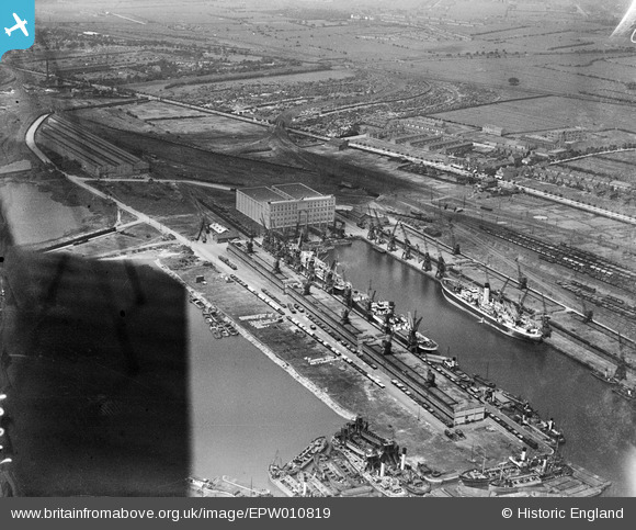
EPW010819 ENGLAND (1924). King George Dock and the Grain Silo, Kingston upon Hull, 1924
© Copyright OpenStreetMap contributors and licensed by the OpenStreetMap Foundation. 2024. Cartography is licensed as CC BY-SA.
Nearby Images (10)
EPW010819

EPW036418

EAW046140

EPW036558

EPW036389

EPW036530

EAW183440

EAW004510

EPW055043

EAW004509

Details
| Title | [EPW010819] King George Dock and the Grain Silo, Kingston upon Hull, 1924 |
| Reference | EPW010819 |
| Date | June-1924 |
| Link | |
| Place name | KINGSTON UPON HULL |
| Parish | |
| District | |
| Country | ENGLAND |
| Easting / Northing | 513914, 429019 |
| Longitude / Latitude | -0.27246900296524, 53.744861657843 |
| National Grid Reference | TA139290 |
Pins
Be the first to add a comment to this image!


