
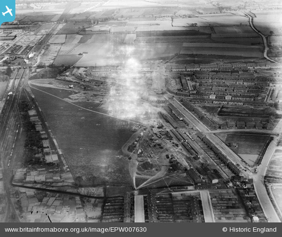
EPW007630 ENGLAND (1922). A new housing development under construction near Chadwell Heath Railway Station, Goodmayes, 1922. This image has been produced from a damaged negative.
© Copyright OpenStreetMap contributors and licensed by the OpenStreetMap Foundation. 2025. Cartography is licensed as CC BY-SA.
Nearby Images (6)
EPW007630

EPW007633

EPW007631

EPW007632

EPW006551

EPW007634

Details
| Title | [EPW007630] A new housing development under construction near Chadwell Heath Railway Station, Goodmayes, 1922. This image has been produced from a damaged negative. |
| Reference | EPW007630 |
| Date | 23-March-1922 |
| Link | |
| Place name | GOODMAYES |
| Parish | |
| District | |
| Country | ENGLAND |
| Easting / Northing | 547301, 187281 |
| Longitude / Latitude | 0.12542633519657, 51.564664365908 |
| National Grid Reference | TQ473873 |
Pins
 Hermann the German |
Wednesday 23rd of October 2013 03:33:25 PM | |
Hermann the German |
Wednesday 23rd of October 2013 03:32:49 PM | |
Hermann the German |
Wednesday 23rd of October 2013 03:30:12 PM | |
Hermann the German |
Wednesday 23rd of October 2013 03:25:40 PM | |
Hermann the German |
Wednesday 23rd of October 2013 03:24:28 PM | |
Hermann the German |
Wednesday 23rd of October 2013 03:08:55 PM | |
Hermann the German |
Wednesday 23rd of October 2013 03:08:28 PM | |
Hermann the German |
Wednesday 23rd of October 2013 03:07:45 PM | |
dillon3333 |
Sunday 29th of September 2013 12:55:30 PM |
User Comment Contributions
The station is Chadwell Heath. The road junction bottom right is Green Lane/Mayfield Road |
John |
Monday 2nd of July 2012 03:00:33 PM |
Dear John, That’s great; we’ve reviewed your comments and thanks to your help we can update the catalogue for this image and the others in the run. The revised records will appear here in due course. Hope you have the same success solving some of our other mysteries! Katy Whitaker Britain from Above Cataloguer |
Katy Whitaker |
Monday 2nd of July 2012 03:00:33 PM |