
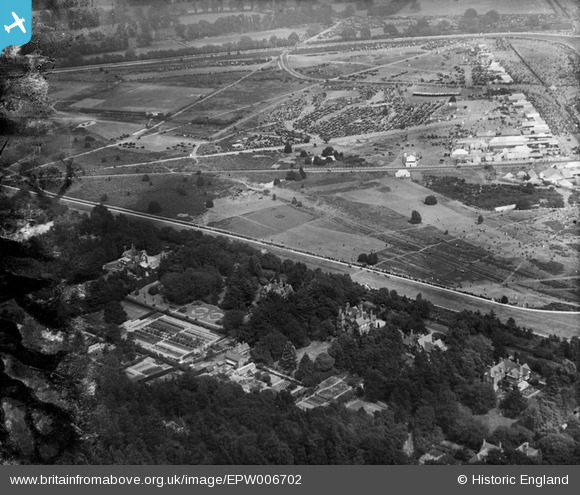
EPW006702 ENGLAND (1921). Ascot, Royal Ascot, 1921
© Copyright OpenStreetMap contributors and licensed by the OpenStreetMap Foundation. 2024. Cartography is licensed as CC BY-SA.
Nearby Images (13)
EPW006702

EAW022114

EPW006700

EAW026661

EAW022115

EPW006708

EAW042137

EPW008710
, Ascot, 1923")
EAW022117

EPW013401

EPW026284

EPW013441

EPW008705

Details
| Title | [EPW006702] Ascot, Royal Ascot, 1921 |
| Reference | EPW006702 |
| Date | June-1921 |
| Link | |
| Place name | ASCOT |
| Parish | SUNNINGHILL AND ASCOT |
| District | |
| Country | ENGLAND |
| Easting / Northing | 491720, 169207 |
| Longitude / Latitude | -0.6809582866925, 51.413960451035 |
| National Grid Reference | SU917692 |
Pins
Be the first to add a comment to this image!