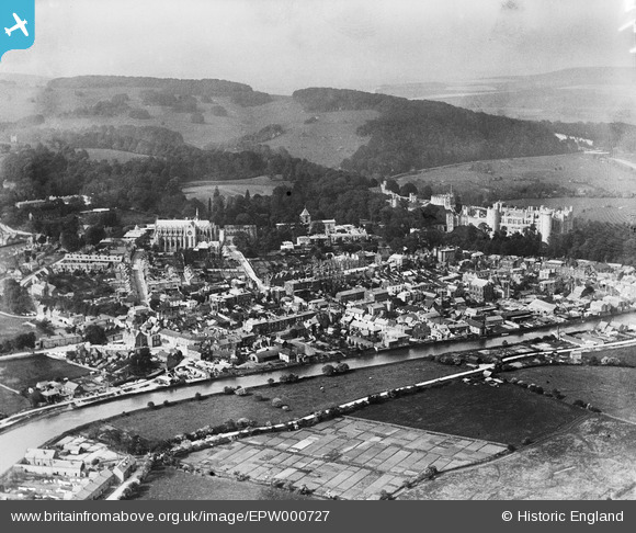
EPW000727 ENGLAND (1920). Arundel, from the south, 1920
© Copyright OpenStreetMap contributors and licensed by the OpenStreetMap Foundation. 2024. Cartography is licensed as CC BY-SA.
Nearby Images (5)
EPW000727

EPW017745

EAW021576

EPW018260

EAW021572

Details
| Title | [EPW000727] Arundel, from the south, 1920 |
| Reference | EPW000727 |
| Date | April-1920 |
| Link | |
| Place name | ARUNDEL |
| Parish | ARUNDEL |
| District | |
| Country | ENGLAND |
| Easting / Northing | 501614, 106886 |
| Longitude / Latitude | -0.55629840024388, 50.851996144676 |
| National Grid Reference | TQ016069 |
Pins
 Alan McFaden |
Sunday 18th of May 2014 07:15:42 PM | |
Alan McFaden |
Sunday 18th of May 2014 07:15:11 PM | |
Alan McFaden |
Sunday 18th of May 2014 07:14:13 PM | |
Alan McFaden |
Sunday 18th of May 2014 07:13:35 PM |