
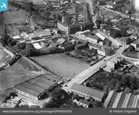
EPR000356 ENGLAND (1934). Crayford Road and the Murgatroyd Bros Ltd Tannery, Crayford, 1934
© Copyright OpenStreetMap contributors and licensed by the OpenStreetMap Foundation. 2024. Cartography is licensed as CC BY-SA.
Nearby Images (9)
EPR000356

EPW028340

EPR000358

EPR000357

EPR000354

EPR000355

EPW057056

EAW048622

EAW048623

Details
| Title | [EPR000356] Crayford Road and the Murgatroyd Bros Ltd Tannery, Crayford, 1934 |
| Reference | EPR000356 |
| Date | 25-September-1934 |
| Link | |
| Place name | CRAYFORD |
| Parish | |
| District | |
| Country | ENGLAND |
| Easting / Northing | 551458, 174677 |
| Longitude / Latitude | 0.17994791122225, 51.450303997258 |
| National Grid Reference | TQ515747 |
Pins
Be the first to add a comment to this image!


