
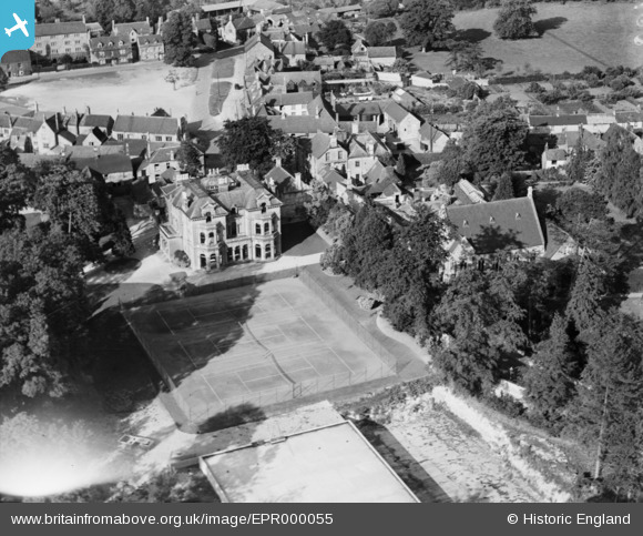
EPR000055 ENGLAND (1934). Woodlands, Calne, 1934. This image has been affected by flare.
© Copyright OpenStreetMap contributors and licensed by the OpenStreetMap Foundation. 2024. Cartography is licensed as CC BY-SA.
Nearby Images (12)
EPR000055

EPR000053

EPR000050

EPW029295

EPR000054

EPW029288

EPR000052

EPR000051

EPW029292

EPW033522

EPW033519

EPW033527

Details
| Title | [EPR000055] Woodlands, Calne, 1934. This image has been affected by flare. |
| Reference | EPR000055 |
| Date | 2-July-1934 |
| Link | |
| Place name | CALNE |
| Parish | CALNE |
| District | |
| Country | ENGLAND |
| Easting / Northing | 399865, 170659 |
| Longitude / Latitude | -2.0019422891538, 51.434439629759 |
| National Grid Reference | ST999707 |
Pins
 Dockgreen |
Monday 29th of December 2014 09:48:28 PM |