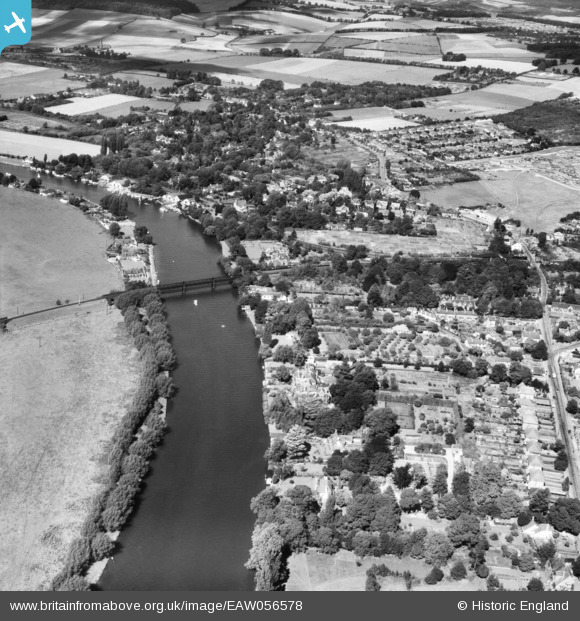
EAW056578 ENGLAND (1954). The railway bridge over the River Thames and environs, Bourne End, 1954
© Copyright OpenStreetMap contributors and licensed by the OpenStreetMap Foundation. 2024. Cartography is licensed as CC BY-SA.
Details
| Title | [EAW056578] The railway bridge over the River Thames and environs, Bourne End, 1954 |
| Reference | EAW056578 |
| Date | 7-September-1954 |
| Link | |
| Place name | BOURNE END |
| Parish | WOOBURN |
| District | |
| Country | ENGLAND |
| Easting / Northing | 489286, 187030 |
| Longitude / Latitude | -0.71144198485067, 51.574582254365 |
| National Grid Reference | SU893870 |
Pins
 daniel14231 |
Monday 30th of December 2019 03:38:58 PM | |
 cafestop |
Wednesday 8th of November 2017 09:13:50 AM | |
 cafestop |
Wednesday 8th of November 2017 09:11:12 AM | |
 cafestop |
Wednesday 8th of November 2017 09:10:27 AM | |
 cafestop |
Wednesday 8th of November 2017 09:09:55 AM | |
 cafestop |
Wednesday 8th of November 2017 09:09:27 AM |


![[EAW056578] The railway bridge over the River Thames and environs, Bourne End, 1954](http://britainfromabove.org.uk/sites/all/libraries/aerofilms-images/public/100x100/EAW/056/EAW056578.jpg)
![[EPW052581] The River Thames near Cock Marsh, Cookham, 1937. This image has been produced from a copy-negative.](http://britainfromabove.org.uk/sites/all/libraries/aerofilms-images/public/100x100/EPW/052/EPW052581.jpg)