
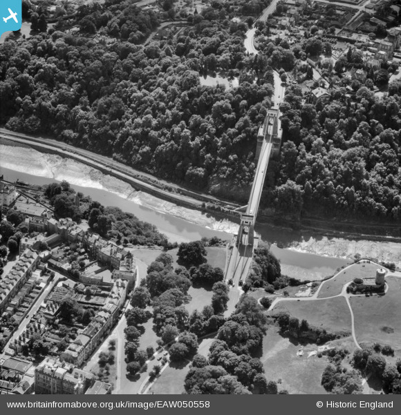
EAW050558 ENGLAND (1953). The Clifton Suspension Bridge, Clifton, 1953
© Copyright OpenStreetMap contributors and licensed by the OpenStreetMap Foundation. 2024. Cartography is licensed as CC BY-SA.
Nearby Images (18)
EAW050558

EAW016132

EPW022272

EPR000063

EAW050559

EAW002263

EPW032539

EAW033325

EPW022273

EAW050560

EPW001274

EPW037150

EPW041480

EAW015138

EAW033323

EAW033327

EPW012024

EPW032526

Details
| Title | [EAW050558] The Clifton Suspension Bridge, Clifton, 1953 |
| Reference | EAW050558 |
| Date | 9-July-1953 |
| Link | |
| Place name | CLIFTON |
| Parish | |
| District | |
| Country | ENGLAND |
| Easting / Northing | 356443, 173005 |
| Longitude / Latitude | -2.6269374541538, 51.453860214187 |
| National Grid Reference | ST564730 |
Pins
Be the first to add a comment to this image!


