
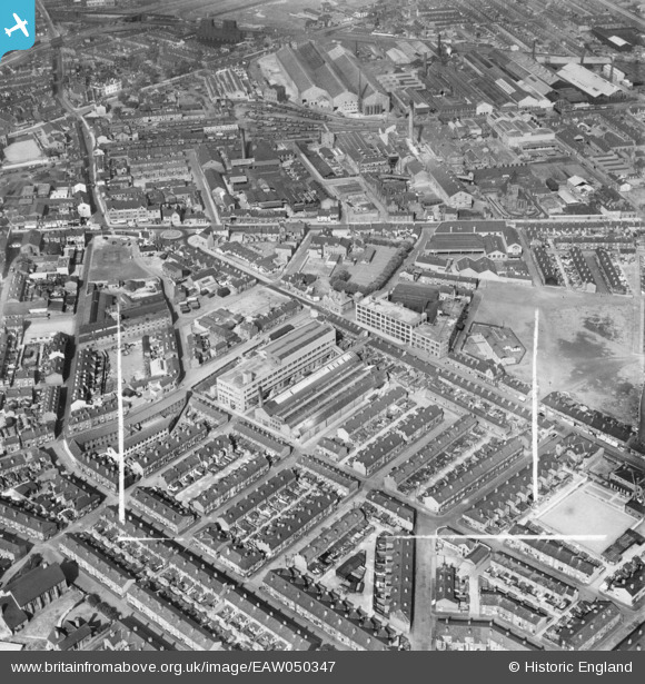
EAW050347 ENGLAND (1953). The Alliance Box Co Ltd Works on Orford Lane and environs, Warrington, 1953. This image was marked by Aerofilms Ltd for photo editing.
© Copyright OpenStreetMap contributors and licensed by the OpenStreetMap Foundation. 2024. Cartography is licensed as CC BY-SA.
Nearby Images (19)
EAW050347

EAW050352

EAW014619

EAW050349

EAW014616

EAW014612

EAW050348

EAW014613

EAW014615

EAW014617

EAW014618

EAW050345

EAW050350

EAW014622

EAW050351

EAW014614

EAW014621

EAW050346

EAW014620

Details
| Title | [EAW050347] The Alliance Box Co Ltd Works on Orford Lane and environs, Warrington, 1953. This image was marked by Aerofilms Ltd for photo editing. |
| Reference | EAW050347 |
| Date | 3-July-1953 |
| Link | |
| Place name | WARRINGTON |
| Parish | |
| District | |
| Country | ENGLAND |
| Easting / Northing | 360765, 388896 |
| Longitude / Latitude | -2.5900952305521, 53.395174018768 |
| National Grid Reference | SJ608889 |
Pins
 redmist |
Monday 20th of July 2020 09:30:22 PM | |
redmist |
Monday 20th of July 2020 09:29:52 PM | |
Neil Bishop |
Monday 25th of August 2014 03:06:40 PM | |
Neil Bishop |
Monday 25th of August 2014 03:06:03 PM | |
Neil Bishop |
Monday 25th of August 2014 03:05:36 PM | |
Neil Bishop |
Monday 25th of August 2014 03:04:56 PM | |
Neil Bishop |
Monday 25th of August 2014 03:04:02 PM | |
Neil Bishop |
Monday 25th of August 2014 03:02:52 PM | |
Neil Bishop |
Monday 25th of August 2014 03:01:58 PM | |
Neil Bishop |
Monday 25th of August 2014 03:01:14 PM |


