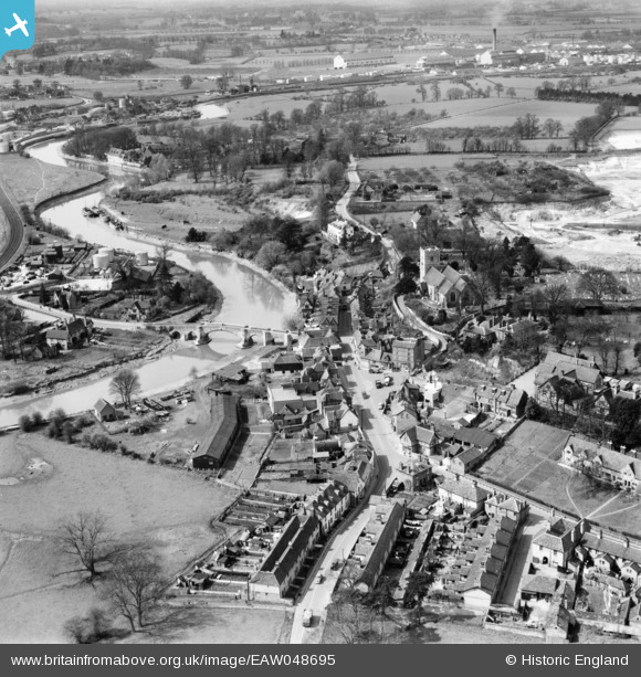
EAW048695 ENGLAND (1953). The village, Aylesford Bridge and environs, Aylesford, 1953
© Copyright OpenStreetMap contributors and licensed by the OpenStreetMap Foundation. 2025. Cartography is licensed as CC BY-SA.
Nearby Images (13)
EAW048695

EAW048694

EPW038104

EPW038096

EAW048696

EPW038105

EPW032111

EPW032114

EPW032112

EPW038100

EPW038101

EPW038099

EPW032113

Details
| Title | [EAW048695] The village, Aylesford Bridge and environs, Aylesford, 1953 |
| Reference | EAW048695 |
| Date | 8-April-1953 |
| Link | |
| Place name | AYLESFORD |
| Parish | AYLESFORD |
| District | |
| Country | ENGLAND |
| Easting / Northing | 572953, 158971 |
| Longitude / Latitude | 0.48138835115772, 51.303040185998 |
| National Grid Reference | TQ730590 |
Pins
 Matt Aldred edob.mattaldred.com |
Saturday 28th of October 2023 11:54:27 AM | |
Matt Aldred edob.mattaldred.com |
Wednesday 24th of March 2021 05:59:35 PM | |
Matt Aldred edob.mattaldred.com |
Wednesday 24th of March 2021 05:55:30 PM | |
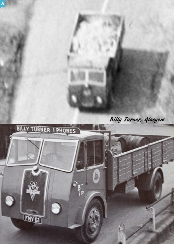
 Billy Turner |
Monday 24th of April 2017 10:26:40 PM |