
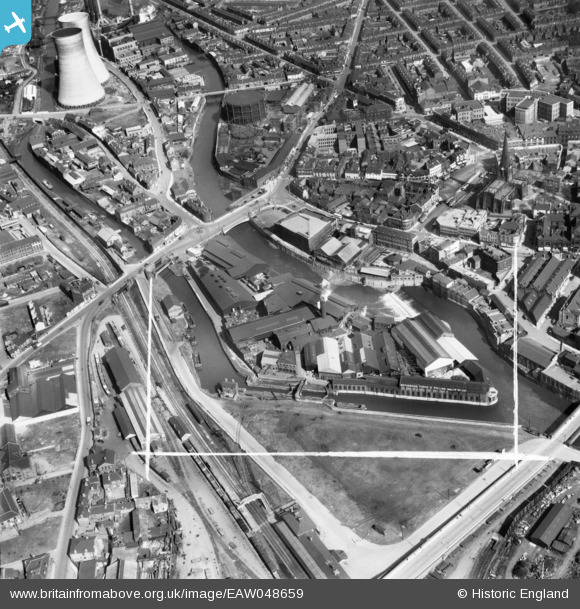
EAW048659 ENGLAND (1953). The Rotherham Forge & Rolling Mills Co Ltd Works on Forge Lane and environs, Rotherham, 1953. This image was marked by Aerofilms Ltd for photo editing.
© Copyright OpenStreetMap contributors and licensed by the OpenStreetMap Foundation. 2024. Cartography is licensed as CC BY-SA.
Nearby Images (10)
EAW048659

EAW048661

EAW048658

EAW048660

EAW048657

EPW015430

EAW048663

EAW048662

EPW015419

EPW015424

Details
| Title | [EAW048659] The Rotherham Forge & Rolling Mills Co Ltd Works on Forge Lane and environs, Rotherham, 1953. This image was marked by Aerofilms Ltd for photo editing. |
| Reference | EAW048659 |
| Date | 3-April-1953 |
| Link | |
| Place name | ROTHERHAM |
| Parish | |
| District | |
| Country | ENGLAND |
| Easting / Northing | 442648, 392936 |
| Longitude / Latitude | -1.3580299280211, 53.431224998363 |
| National Grid Reference | SK426929 |


