
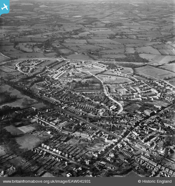
EAW041931 ENGLAND (1952). The town centre and construction of the West Green neighbourhood, West Green, 1952
© Copyright OpenStreetMap contributors and licensed by the OpenStreetMap Foundation. 2024. Cartography is licensed as CC BY-SA.
Nearby Images (6)
EAW041931

EAW041923

EAW037054

EAW037053

EAW011068

EAW041929

Details
| Title | [EAW041931] The town centre and construction of the West Green neighbourhood, West Green, 1952 |
| Reference | EAW041931 |
| Date | 14-March-1952 |
| Link | |
| Place name | WEST GREEN |
| Parish | |
| District | |
| Country | ENGLAND |
| Easting / Northing | 526298, 136779 |
| Longitude / Latitude | -0.19537106047654, 51.115836447762 |
| National Grid Reference | TQ263368 |


