
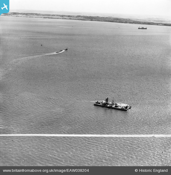
EAW038204 ENGLAND (1951). The Sliedrecht VIII, north of Sheerness, 1951. This image has been produced from a print marked by Aerofilms Ltd for photo editing. UNLOCATED.
© Copyright OpenStreetMap contributors and licensed by the OpenStreetMap Foundation. 2024. Cartography is licensed as CC BY-SA.
Nearby Images (2)
EAW038204

EAW044145

Details
| Title | [EAW038204] The Sliedrecht VIII, north of Sheerness, 1951. This image has been produced from a print marked by Aerofilms Ltd for photo editing. UNLOCATED. |
| Reference | EAW038204 |
| Date | 2-August-1951 |
| Link | |
| Place name | SHEERNESS |
| Parish | |
| District | |
| Country | ENGLAND |
| Easting / Northing | 592269, 175941 |
| Longitude / Latitude | 0.7673727080275, 51.449272366231 |
| National Grid Reference | TQ923759 |
Pins
 Class31 |
Saturday 28th of February 2015 09:23:29 PM | |
Class31 |
Saturday 28th of February 2015 09:13:01 PM | |
Class31 |
Saturday 28th of February 2015 09:04:44 PM |