
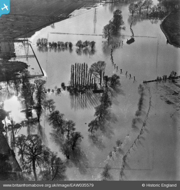
EAW035579 ENGLAND (1951). The River Great Ouse in flood by the Transport Depot, Kempston, 1951. This image has been produced from a print marked by Aerofilms Ltd for photo editing.
© Copyright OpenStreetMap contributors and licensed by the OpenStreetMap Foundation. 2024. Cartography is licensed as CC BY-SA.
Nearby Images (6)
EAW035579

EAW035578

EPW046442

EPW046440

EAW018301

EAW003720

Details
| Title | [EAW035579] The River Great Ouse in flood by the Transport Depot, Kempston, 1951. This image has been produced from a print marked by Aerofilms Ltd for photo editing. |
| Reference | EAW035579 |
| Date | 11-April-1951 |
| Link | |
| Place name | KEMPSTON |
| Parish | KEMPSTON |
| District | |
| Country | ENGLAND |
| Easting / Northing | 504029, 248858 |
| Longitude / Latitude | -0.48013706464894, 52.127816124857 |
| National Grid Reference | TL040489 |
Pins
 melgibbs |
Tuesday 11th of November 2014 11:15:41 AM | |
melgibbs |
Sunday 9th of November 2014 10:40:57 AM | |
melgibbs |
Sunday 9th of November 2014 10:39:53 AM | |
melgibbs |
Sunday 9th of November 2014 10:37:25 AM | |
melgibbs |
Sunday 9th of November 2014 10:36:22 AM | |
melgibbs |
Sunday 9th of November 2014 10:31:33 AM | |
melgibbs |
Saturday 8th of November 2014 04:27:27 PM | |
melgibbs |
Saturday 8th of November 2014 04:26:45 PM | |
melgibbs |
Saturday 8th of November 2014 04:25:37 PM |


