
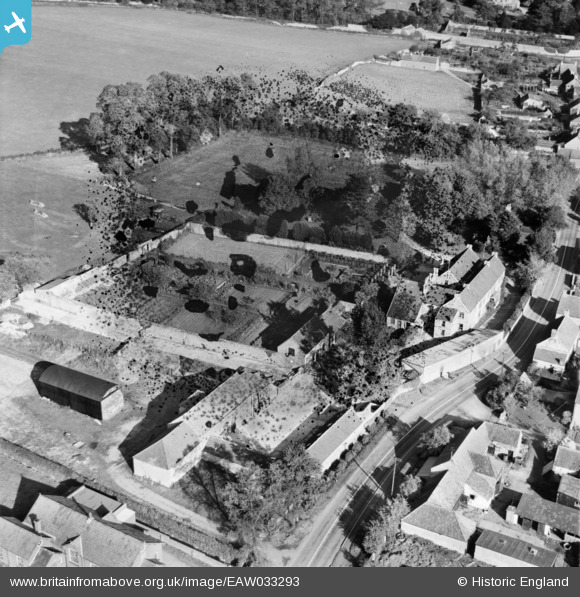
EAW033293 ENGLAND (1950). Tockington Court and Court Farm, Tockington, 1950. This image has been produced from a damaged negative.
© Copyright OpenStreetMap contributors and licensed by the OpenStreetMap Foundation. 2024. Cartography is licensed as CC BY-SA.
Nearby Images (8)
EAW033293

EAW033295

EAW033294

EAW033291

EAW033297

EAW033292

EAW033296

EAW033313

Details
| Title | [EAW033293] Tockington Court and Court Farm, Tockington, 1950. This image has been produced from a damaged negative. |
| Reference | EAW033293 |
| Date | 5-October-1950 |
| Link | |
| Place name | TOCKINGTON |
| Parish | OLVESTON |
| District | |
| Country | ENGLAND |
| Easting / Northing | 360671, 186641 |
| Longitude / Latitude | -2.5676071065657, 51.576785290426 |
| National Grid Reference | ST607866 |
Pins
Be the first to add a comment to this image!