
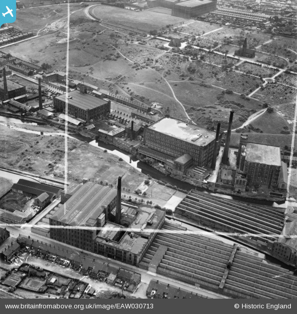
EAW030713 ENGLAND (1950). The Park Road Spinning Co Ltd Mill and the cemetery, Dukinfield, 1950. This image was marked by Aerofilms Ltd for photo editing.
© Copyright OpenStreetMap contributors and licensed by the OpenStreetMap Foundation. 2024. Cartography is licensed as CC BY-SA.
Nearby Images (16)
EAW030713

EAW030714

EAW004394

EAW030709

EAW030711

EAW004393

EAW030715

EAW030716

EAW004397

EAW030712

EAW030710

EAW004395

EAW004398

EAW030718

EAW030717

EAW004396

Details
| Title | [EAW030713] The Park Road Spinning Co Ltd Mill and the cemetery, Dukinfield, 1950. This image was marked by Aerofilms Ltd for photo editing. |
| Reference | EAW030713 |
| Date | June-1950 |
| Link | |
| Place name | DUKINFIELD |
| Parish | |
| District | |
| Country | ENGLAND |
| Easting / Northing | 394595, 398425 |
| Longitude / Latitude | -2.0814572984166, 53.482265788384 |
| National Grid Reference | SJ946984 |
Pins
 stardelta |
Saturday 14th of June 2014 08:18:49 PM | |
stardelta |
Saturday 14th of June 2014 08:17:51 PM | |
stardelta |
Saturday 14th of June 2014 08:17:09 PM | |
stardelta |
Saturday 14th of June 2014 08:16:34 PM | |
stardelta |
Saturday 14th of June 2014 08:16:03 PM |


