
Scheduled Maintenance
This website will undergo scheduled maintenance on Tuesday, September 10th, between 11:00 and 15:00, as well as on Thursday, September 12th, between 10:00 and 12:00. During this time, services may be temporarily disrupted. We apologise for any inconvenience.
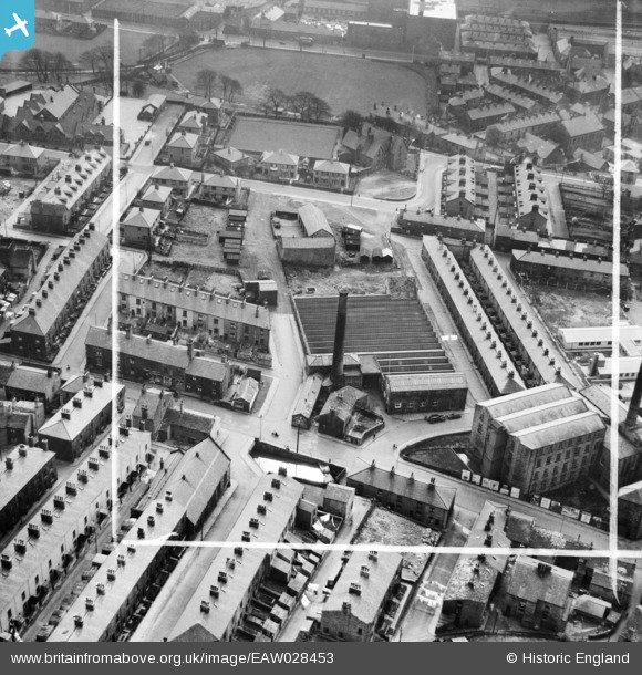
EAW028453 ENGLAND (1950). Higher Mill, Rawtenstall, 1950. This image was marked by Aerofilms Ltd for photo editing.
© Copyright OpenStreetMap contributors and licensed by the OpenStreetMap Foundation. 2024. Cartography is licensed as CC BY-SA.
Nearby Images (7)
EAW028453

EAW028458

EAW028452

EAW028456

EAW028455

EAW028454

EAW028457

Details
| Title | [EAW028453] Higher Mill, Rawtenstall, 1950. This image was marked by Aerofilms Ltd for photo editing. |
| Reference | EAW028453 |
| Date | 25-March-1950 |
| Link | |
| Place name | RAWTENSTALL |
| Parish | |
| District | |
| Country | ENGLAND |
| Easting / Northing | 381427, 423071 |
| Longitude / Latitude | -2.2813750351444, 53.703513953079 |
| National Grid Reference | SD814231 |
Pins
Be the first to add a comment to this image!