
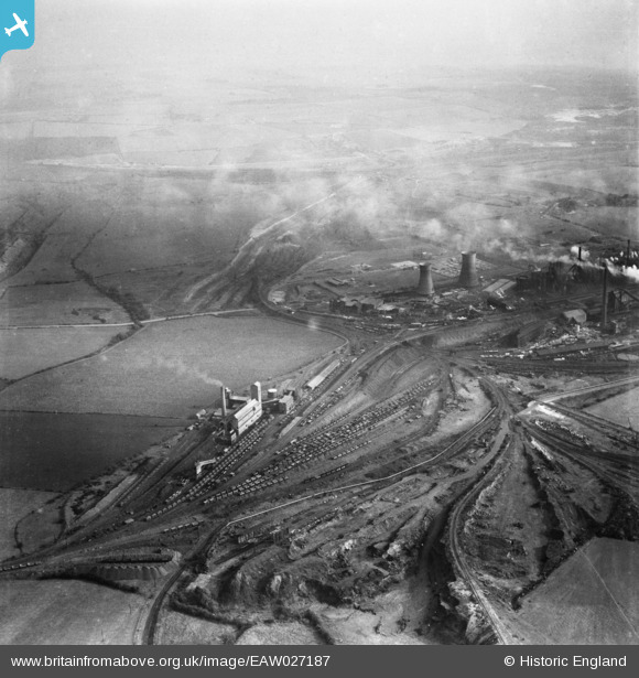
EAW027187 ENGLAND (1949). The northern end of the John Lysaght Normanby Park Steel Works, Scunthorpe, from the west, 1949
© Copyright OpenStreetMap contributors and licensed by the OpenStreetMap Foundation. 2024. Cartography is licensed as CC BY-SA.
Nearby Images (24)
EAW027187

EAW041861

EAW034799

EAW019672

EAW009624

EAW031189

EAW009633

EAW009625

EAW021133

EAW028579

EAW021134

EAW023931

EAW019671

EAW028580

EAW023929

EAW023930

EAW019670

EAW009628

EAW041864

EAW021135

EAW018599G

EAW041860

EAW009634

EAW028562

Details
| Title | [EAW027187] The northern end of the John Lysaght Normanby Park Steel Works, Scunthorpe, from the west, 1949 |
| Reference | EAW027187 |
| Date | 12-October-1949 |
| Link | |
| Place name | SCUNTHORPE |
| Parish | |
| District | |
| Country | ENGLAND |
| Easting / Northing | 488294, 414416 |
| Longitude / Latitude | -0.66502581266986, 53.618597934793 |
| National Grid Reference | SE883144 |
Pins
Be the first to add a comment to this image!