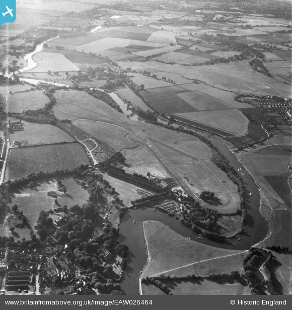
EAW026464 ENGLAND (1949). Windsor, Race day at Royal Windsor Racecourse, 1949. This image has been produced from a print marked by Aerofilms Ltd for photo editing.
© Copyright OpenStreetMap contributors and licensed by the OpenStreetMap Foundation. 2025. Cartography is licensed as CC BY-SA.
Nearby Images (5)
Details
| Title | [EAW026464] Windsor, Race day at Royal Windsor Racecourse, 1949. This image has been produced from a print marked by Aerofilms Ltd for photo editing. |
| Reference | EAW026464 |
| Date | 10-September-1949 |
| Link | |
| Place name | WINDSOR |
| Parish | |
| District | |
| Country | ENGLAND |
| Easting / Northing | 494845, 177643 |
| Longitude / Latitude | -0.63376837196833, 51.489286049313 |
| National Grid Reference | SU948776 |
Pins
Be the first to add a comment to this image!


![[EAW026464] Windsor, Race day at Royal Windsor Racecourse, 1949. This image has been produced from a print marked by Aerofilms Ltd for photo editing.](http://britainfromabove.org.uk/sites/all/libraries/aerofilms-images/public/100x100/EAW/026/EAW026464.jpg)
![[EAW026465] Windsor, Race day at Royal Windsor Racecourse, 1949. This image has been produced from a print marked by Aerofilms Ltd for photo editing.](http://britainfromabove.org.uk/sites/all/libraries/aerofilms-images/public/100x100/EAW/026/EAW026465.jpg)
![[EAW026466] Windsor, Race day at Royal Windsor Racecourse, 1949. This image has been produced from a damaged negative.](http://britainfromabove.org.uk/sites/all/libraries/aerofilms-images/public/100x100/EAW/026/EAW026466.jpg)
![[EAW026460] Windsor, Race day at Royal Windsor Racecourse, 1949. This image has been produced from a print marked by Aerofilms Ltd for photo editing.](http://britainfromabove.org.uk/sites/all/libraries/aerofilms-images/public/100x100/EAW/026/EAW026460.jpg)
![[EPW031203] The River Thames flood at Royal Windsor Race Course, Windsor, 1929](http://britainfromabove.org.uk/sites/all/libraries/aerofilms-images/public/100x100/EPW/031/EPW031203.jpg)