
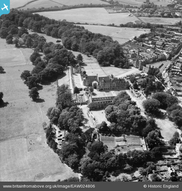
EAW024806 ENGLAND (1949). Battle Abbey School and the abbey ruins, Battle, 1949
© Copyright OpenStreetMap contributors and licensed by the OpenStreetMap Foundation. 2024. Cartography is licensed as CC BY-SA.
Nearby Images (13)
EAW024806

EAW024805

EPW026217

EPW026214

EPW000613

EPW026215

EAW024803

EPW000680

EPW000677

EAW024807

EPW000763

EAW024804

EPW026213

Details
| Title | [EAW024806] Battle Abbey School and the abbey ruins, Battle, 1949 |
| Reference | EAW024806 |
| Date | 12-July-1949 |
| Link | |
| Place name | BATTLE |
| Parish | BATTLE |
| District | |
| Country | ENGLAND |
| Easting / Northing | 574912, 115656 |
| Longitude / Latitude | 0.48846638384569, 50.913275784015 |
| National Grid Reference | TQ749157 |
Pins
Be the first to add a comment to this image!


