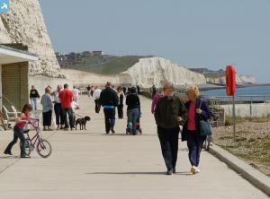
EAW024797 ENGLAND (1949). Marine Drive and environs, Saltdean, 1949
© Copyright OpenStreetMap contributors and licensed by the OpenStreetMap Foundation. 2024. Cartography is licensed as CC BY-SA.
Details
| Title | [EAW024797] Marine Drive and environs, Saltdean, 1949 |
| Reference | EAW024797 |
| Date | 12-July-1949 |
| Link | |
| Place name | SALTDEAN |
| Parish | |
| District | |
| Country | ENGLAND |
| Easting / Northing | 538339, 101934 |
| Longitude / Latitude | -0.036673016655575, 50.79986794211 |
| National Grid Reference | TQ383019 |
Pins
 printerspie |
Monday 2nd of August 2021 08:58:32 AM | |
 moke72 |
Sunday 12th of January 2014 04:51:39 PM | |
 moke72 |
Sunday 12th of January 2014 04:47:45 PM | |
 Alan McFaden |
Sunday 12th of January 2014 09:43:12 AM | |
 Alan McFaden |
Sunday 12th of January 2014 09:40:18 AM | |
 Switches |
Saturday 21st of December 2013 04:27:35 PM |


![[EAW024797] Marine Drive and environs, Saltdean, 1949](http://britainfromabove.org.uk/sites/all/libraries/aerofilms-images/public/100x100/EAW/024/EAW024797.jpg)
![[EAW024796] The Ocean Hotel and environs, Saltdean, 1949](http://britainfromabove.org.uk/sites/all/libraries/aerofilms-images/public/100x100/EAW/024/EAW024796.jpg)
![[EAW024798] The Ocean Hotel and environs, Saltdean, 1949](http://britainfromabove.org.uk/sites/all/libraries/aerofilms-images/public/100x100/EAW/024/EAW024798.jpg)


