
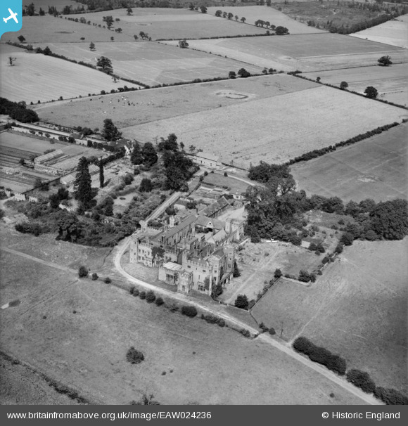
EAW024236 ENGLAND (1949). Sundorne Castle, Uffington, 1949
© Copyright OpenStreetMap contributors and licensed by the OpenStreetMap Foundation. 2024. Cartography is licensed as CC BY-SA.
Nearby Images (5)
EAW024236

EPW040076

EAW024238

EAW024235

EAW024237

Details
| Title | [EAW024236] Sundorne Castle, Uffington, 1949 |
| Reference | EAW024236 |
| Date | 27-June-1949 |
| Link | |
| Place name | UFFINGTON |
| Parish | UFFINGTON |
| District | |
| Country | ENGLAND |
| Easting / Northing | 352792, 315256 |
| Longitude / Latitude | -2.699197467744, 52.732538793156 |
| National Grid Reference | SJ528153 |
Pins
Be the first to add a comment to this image!


