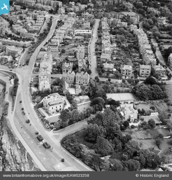
EAW023258 ENGLAND (1949). Elton Road and Hallam Road, Clevedon, 1949
© Copyright OpenStreetMap contributors and licensed by the OpenStreetMap Foundation. 2024. Cartography is licensed as CC BY-SA.
Nearby Images (8)
Details
| Title | [EAW023258] Elton Road and Hallam Road, Clevedon, 1949 |
| Reference | EAW023258 |
| Date | 23-May-1949 |
| Link | |
| Place name | CLEVEDON |
| Parish | CLEVEDON |
| District | |
| Country | ENGLAND |
| Easting / Northing | 340163, 171502 |
| Longitude / Latitude | -2.8609847567221, 51.438858948798 |
| National Grid Reference | ST402715 |
Pins
 Matt Aldred edob.mattaldred.com |
Thursday 14th of March 2024 11:51:47 AM | |
 jkt1250 |
Tuesday 10th of July 2018 07:36:07 AM | |
 Class31 |
Saturday 21st of February 2015 07:59:28 PM | |
 Class31 |
Saturday 21st of February 2015 07:58:33 PM | |
 Class31 |
Saturday 21st of February 2015 07:57:40 PM | |
 Class31 |
Saturday 21st of February 2015 07:54:48 PM | |
 Class31 |
Saturday 21st of February 2015 07:54:07 PM | |
 PFC |
Saturday 21st of February 2015 06:18:04 PM |


![[EAW023258] Elton Road and Hallam Road, Clevedon, 1949](http://britainfromabove.org.uk/sites/all/libraries/aerofilms-images/public/100x100/EAW/023/EAW023258.jpg)
![[EAW023256] St Brandon's Junior School (Oaklands) on Elton Road and environs, Clevedon, 1949. This image was marked by Aerofilms Ltd for photo editing.](http://britainfromabove.org.uk/sites/all/libraries/aerofilms-images/public/100x100/EAW/023/EAW023256.jpg)
![[EAW023257] St Brandon's Junior School (Oaklands) on Elton Road and environs, Clevedon, from the north-west, 1949. This image was marked by Aerofilms Ltd for photo editing.](http://britainfromabove.org.uk/sites/all/libraries/aerofilms-images/public/100x100/EAW/023/EAW023257.jpg)
![[EPW024060] Green Beach and environs, Clevedon, 1928](http://britainfromabove.org.uk/sites/all/libraries/aerofilms-images/public/100x100/EPW/024/EPW024060.jpg)
![[EPW033271] Albert Road and environs, Clevedon, 1930](http://britainfromabove.org.uk/sites/all/libraries/aerofilms-images/public/100x100/EPW/033/EPW033271.jpg)
![[EPW008629] Victoria Road, Albert Road and Hallam Road, Clevedon, 1923. This image has been produced from a copy-negative.](http://britainfromabove.org.uk/sites/all/libraries/aerofilms-images/public/100x100/EPW/008/EPW008629.jpg)
![[EPW024057] Copse Road and environs, Clevedon, 1928](http://britainfromabove.org.uk/sites/all/libraries/aerofilms-images/public/100x100/EPW/024/EPW024057.jpg)
![[EPW024066] The Beach and environs, Clevedon, 1928](http://britainfromabove.org.uk/sites/all/libraries/aerofilms-images/public/100x100/EPW/024/EPW024066.jpg)