
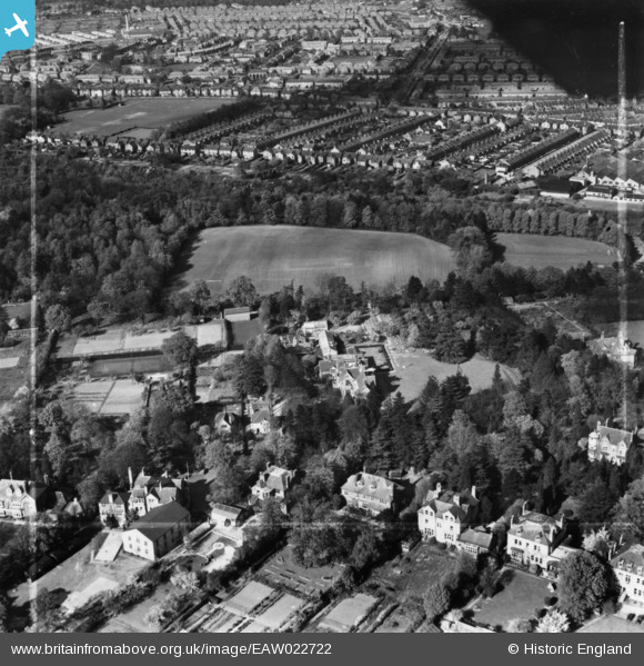
EAW022722 ENGLAND (1949). Shirley House Preparatory School for Boys, adjacent playing field and environs, Watford, 1949. This image has been produced from a print marked by Aerofilms Ltd for photo editing.
© Copyright OpenStreetMap contributors and licensed by the OpenStreetMap Foundation. 2024. Cartography is licensed as CC BY-SA.
Nearby Images (6)
EAW022722

EAW022719

EAW022721

EAW022720

EPW006199

EPW010438

Details
| Title | [EAW022722] Shirley House Preparatory School for Boys, adjacent playing field and environs, Watford, 1949. This image has been produced from a print marked by Aerofilms Ltd for photo editing. |
| Reference | EAW022722 |
| Date | 2-May-1949 |
| Link | |
| Place name | WATFORD |
| Parish | |
| District | |
| Country | ENGLAND |
| Easting / Northing | 510196, 198007 |
| Longitude / Latitude | -0.40633281258335, 51.669552669476 |
| National Grid Reference | TQ102980 |
Pins
Be the first to add a comment to this image!


