
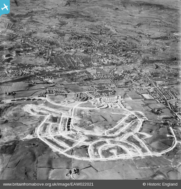
EAW022021 ENGLAND (1949). Kirkholt housing estate under construction, Rochdale, from the south, 1949
© Copyright OpenStreetMap contributors and licensed by the OpenStreetMap Foundation. 2024. Cartography is licensed as CC BY-SA.
Nearby Images (2)
EAW022021

EAW022020

Details
| Title | [EAW022021] Kirkholt housing estate under construction, Rochdale, from the south, 1949 |
| Reference | EAW022021 |
| Date | 14-April-1949 |
| Link | |
| Place name | ROCHDALE |
| Parish | |
| District | |
| Country | ENGLAND |
| Easting / Northing | 389788, 410826 |
| Longitude / Latitude | -2.1543068835343, 53.593671660347 |
| National Grid Reference | SD898108 |
Pins
 Mark Heyhoe |
Tuesday 27th of June 2023 04:08:18 PM | |
redmist |
Thursday 15th of July 2021 10:02:23 PM | |
redmist |
Thursday 15th of July 2021 10:01:30 PM | |
redmist |
Thursday 15th of July 2021 10:00:10 PM | |
redmist |
Thursday 15th of July 2021 09:57:50 PM | |
redmist |
Thursday 15th of July 2021 09:55:44 PM | |
redmist |
Thursday 15th of July 2021 09:45:00 PM | |
Mikeya |
Wednesday 28th of November 2018 10:29:59 PM | |
HILLARY |
Saturday 16th of May 2015 02:16:10 PM | |
Mikeya |
Sunday 6th of April 2014 11:03:15 AM | |
Mikeya |
Sunday 6th of April 2014 11:02:05 AM | |
Mikeya |
Sunday 6th of April 2014 11:00:42 AM | |
Mikeya |
Sunday 6th of April 2014 10:59:58 AM | |
Mikeya |
Sunday 6th of April 2014 10:59:23 AM | |
Mikeya |
Sunday 6th of April 2014 10:57:45 AM | |
Mikeya |
Sunday 6th of April 2014 10:56:47 AM | |
Mikeya |
Sunday 6th of April 2014 10:56:09 AM | |
Mikeya |
Sunday 6th of April 2014 10:55:31 AM |