
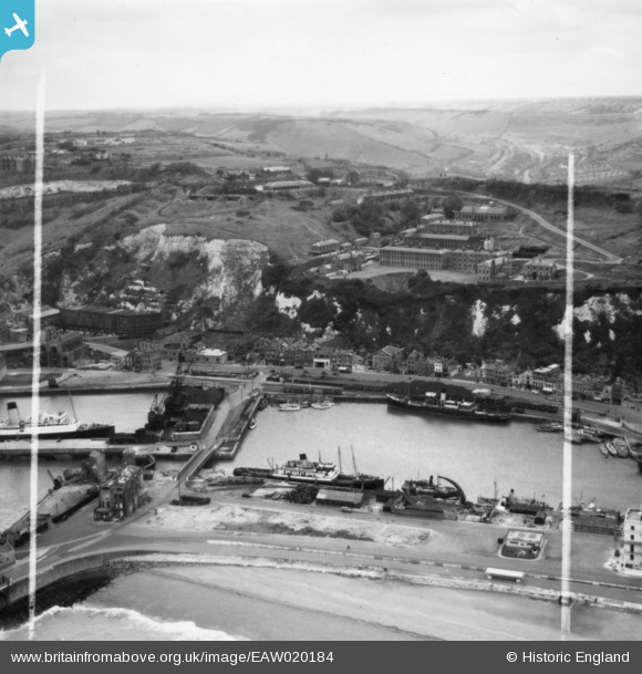
EAW020184 ENGLAND (1948). Wellington Dock and environs, Dover, from the east, 1948. This image has been produced from a print marked by Aerofilms Ltd for photo editing.
© Copyright OpenStreetMap contributors and licensed by the OpenStreetMap Foundation. 2024. Cartography is licensed as CC BY-SA.
Nearby Images (16)
EAW020184

EAW020180

EAW020174

EAW020173

EAW020172

EAW020170

EAW020171

EAW020183

EAW020181

EAW020179

EAW020169

EAW020182

EPW019054

EAW030082

EPW000357

EPW039374

Details
| Title | [EAW020184] Wellington Dock and environs, Dover, from the east, 1948. This image has been produced from a print marked by Aerofilms Ltd for photo editing. |
| Reference | EAW020184 |
| Date | 28-October-1948 |
| Link | |
| Place name | DOVER |
| Parish | DOVER |
| District | |
| Country | ENGLAND |
| Easting / Northing | 631888, 140854 |
| Longitude / Latitude | 1.3139011350747, 51.119438444967 |
| National Grid Reference | TR319409 |
Pins
 The Laird |
Saturday 9th of May 2015 11:54:43 AM |