
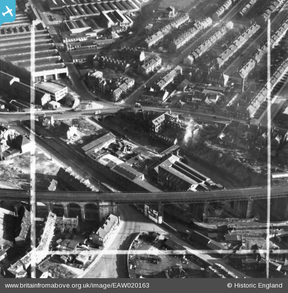
EAW020163 ENGLAND (1948). Cliffe and Co Ltd Longroyd Bridge Iron Works and environs, Huddersfield, 1948. This image has been produced from a print marked by Aerofilms Ltd for photo editing.
© Copyright OpenStreetMap contributors and licensed by the OpenStreetMap Foundation. 2024. Cartography is licensed as CC BY-SA.
Nearby Images (24)
EAW020163

EAW020168

EAW020162

EAW020164

EAW020167

EAW020165

EAW020166

EAW047444

EAW047743

EAW047443

EAW047439

EAW047447

EAW047442

EAW047445

EAW047741

EAW050471

EAW050467

EAW050468

EAW050465

EAW050466

EAW050472

EAW050469

EAW047446

EAW047744

Details
| Title | [EAW020163] Cliffe and Co Ltd Longroyd Bridge Iron Works and environs, Huddersfield, 1948. This image has been produced from a print marked by Aerofilms Ltd for photo editing. |
| Reference | EAW020163 |
| Date | 19-October-1948 |
| Link | |
| Place name | HUDDERSFIELD |
| Parish | |
| District | |
| Country | ENGLAND |
| Easting / Northing | 413509, 416078 |
| Longitude / Latitude | -1.7956467290144, 53.640808474141 |
| National Grid Reference | SE135161 |
Pins
Be the first to add a comment to this image!