
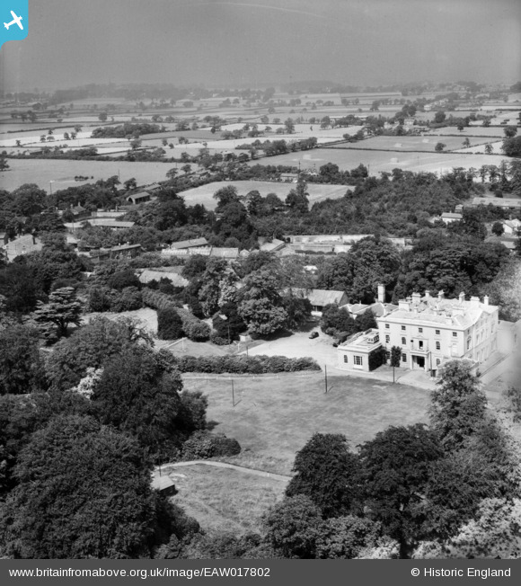
EAW017802 ENGLAND (1948). Highlegh Hall, High Legh, from the south, 1948
© Copyright OpenStreetMap contributors and licensed by the OpenStreetMap Foundation. 2024. Cartography is licensed as CC BY-SA.
Nearby Images (5)
EAW017802

EAW017804

EAW017803

EAW017801

EAW017805

Details
| Title | [EAW017802] Highlegh Hall, High Legh, from the south, 1948 |
| Reference | EAW017802 |
| Date | 28-July-1948 |
| Link | |
| Place name | HIGH LEGH |
| Parish | HIGH LEGH |
| District | |
| Country | ENGLAND |
| Easting / Northing | 370165, 383865 |
| Longitude / Latitude | -2.4482494579632, 53.35056341506 |
| National Grid Reference | SJ702839 |
Pins
Be the first to add a comment to this image!
User Comment Contributions
I think this is also known as East Hall. Now demolished |
 James Chandler |
Sunday 30th of August 2015 07:15:06 PM |


