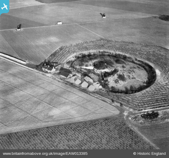
EAW013385 ENGLAND (1948). Fort Farningham, Farningham, 1948. This image has been produced from a print.
© Copyright OpenStreetMap contributors and licensed by the OpenStreetMap Foundation. 2025. Cartography is licensed as CC BY-SA.
Nearby Images (5)
Details
| Title | [EAW013385] Fort Farningham, Farningham, 1948. This image has been produced from a print. |
| Reference | EAW013385 |
| Date | 16-February-1948 |
| Link | |
| Place name | FARNINGHAM |
| Parish | FARNINGHAM |
| District | |
| Country | ENGLAND |
| Easting / Northing | 553270, 166912 |
| Longitude / Latitude | 0.2026500374475, 51.380040257413 |
| National Grid Reference | TQ533669 |
Pins
User Comment Contributions
 cptpies |
Tuesday 31st of March 2015 10:58:00 AM |


![[EAW013385] Fort Farningham, Farningham, 1948. This image has been produced from a print.](http://britainfromabove.org.uk/sites/all/libraries/aerofilms-images/public/100x100/EAW/013/EAW013385.jpg)
![[EAW013381] Fort Farningham, Farningham, 1948. This image has been produced from a print.](http://britainfromabove.org.uk/sites/all/libraries/aerofilms-images/public/100x100/EAW/013/EAW013381.jpg)
![[EAW013384] Fort Farningham, Farningham, 1948. This image has been produced from a print.](http://britainfromabove.org.uk/sites/all/libraries/aerofilms-images/public/100x100/EAW/013/EAW013384.jpg)
![[EAW013382] Fort Farningham, Farningham, 1948. This image has been produced from a print.](http://britainfromabove.org.uk/sites/all/libraries/aerofilms-images/public/100x100/EAW/013/EAW013382.jpg)
![[EAW013383] Fort Farningham, Farningham, 1948. This image has been produced from a print.](http://britainfromabove.org.uk/sites/all/libraries/aerofilms-images/public/100x100/EAW/013/EAW013383.jpg)
