
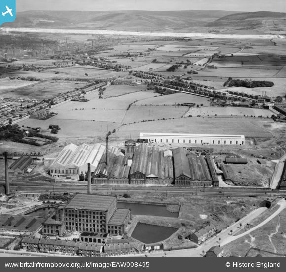
EAW008495 ENGLAND (1947). The Daniel Adamson and Co Engineering Works, Dukinfield, from the south-west, 1947. This image was marked by Aerofilms Ltd for photo editing.
© Copyright OpenStreetMap contributors and licensed by the OpenStreetMap Foundation. 2024. Cartography is licensed as CC BY-SA.
Nearby Images (33)
EAW008495

EAW008497

EAW037552

EAW052648

EAW026618

EAW037544

EAW026619

EAW052646

EAW026620

EAW037546

EAW008494

EAW026616

EAW026617

EAW008501

EAW037545

EAW037548

EAW008500

EAW026611

EAW052649

EAW026614
, Dukinfield, 1949. This image has been produced from a damaged negative.")
EAW008496

EAW037550

EAW037547

EAW037551

EAW037549

EAW052647

EAW026615

EAW008499

EAW026613
, Dukinfield, 1949. This image has been produced from a damaged negative.")
EAW026621

EAW008502

EAW008498

EAW037553

Details
| Title | [EAW008495] The Daniel Adamson and Co Engineering Works, Dukinfield, from the south-west, 1947. This image was marked by Aerofilms Ltd for photo editing. |
| Reference | EAW008495 |
| Date | 22-July-1947 |
| Link | |
| Place name | DUKINFIELD |
| Parish | |
| District | |
| Country | ENGLAND |
| Easting / Northing | 394355, 396564 |
| Longitude / Latitude | -2.0850408178088, 53.465533825676 |
| National Grid Reference | SJ944966 |
Pins
 seligs |
Saturday 18th of April 2020 05:30:02 PM | |
seligs |
Saturday 18th of April 2020 05:26:23 PM | |
John Wass |
Friday 15th of May 2015 09:10:43 PM | |
stardelta |
Saturday 14th of June 2014 06:49:19 PM | |
Globe Lane Pals |
Friday 16th of May 2014 01:48:21 PM |


