
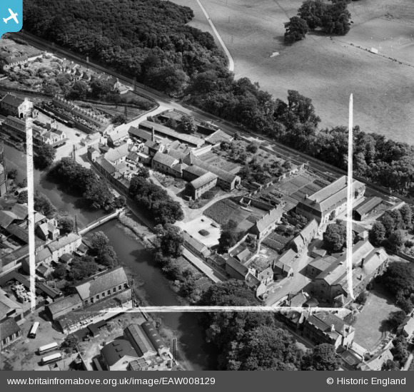
EAW008129 ENGLAND (1947). Brewery and malt house buildings between Barnack Road and Water Street, Stamford, 1947. This image was marked by Aerofilms Ltd for photo editing.
© Copyright OpenStreetMap contributors and licensed by the OpenStreetMap Foundation. 2024. Cartography is licensed as CC BY-SA.
Nearby Images (10)
EAW008129

EAW008128

EAW008125

EAW008127

EAW008126

EAW008132

EAW008130

EAW008131

EPW054984

EPW054983

Details
| Title | [EAW008129] Brewery and malt house buildings between Barnack Road and Water Street, Stamford, 1947. This image was marked by Aerofilms Ltd for photo editing. |
| Reference | EAW008129 |
| Date | 12-July-1947 |
| Link | |
| Place name | STAMFORD |
| Parish | STAMFORD |
| District | |
| Country | ENGLAND |
| Easting / Northing | 503344, 306854 |
| Longitude / Latitude | -0.47224612043032, 52.64921186735 |
| National Grid Reference | TF033069 |
Pins
 John W |
Tuesday 28th of June 2016 05:06:50 PM | |
John W |
Tuesday 28th of June 2016 04:33:54 PM |