
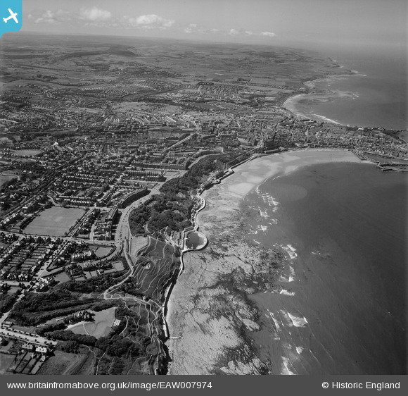
EAW007974 ENGLAND (1947). South Bay and the town, Scarborough, from the south-east, 1947
© Copyright OpenStreetMap contributors and licensed by the OpenStreetMap Foundation. 2024. Cartography is licensed as CC BY-SA.
Nearby Images (6)
EAW007974

EPW038933

EAW007938

EPW038934

EAW007943

EAW007940

Details
| Title | [EAW007974] South Bay and the town, Scarborough, from the south-east, 1947 |
| Reference | EAW007974 |
| Date | 26-June-1947 |
| Link | |
| Place name | SCARBOROUGH |
| Parish | |
| District | |
| Country | ENGLAND |
| Easting / Northing | 504810, 487320 |
| Longitude / Latitude | -0.39037784995751, 54.270617343271 |
| National Grid Reference | TA048873 |
Pins

User Comment Contributions
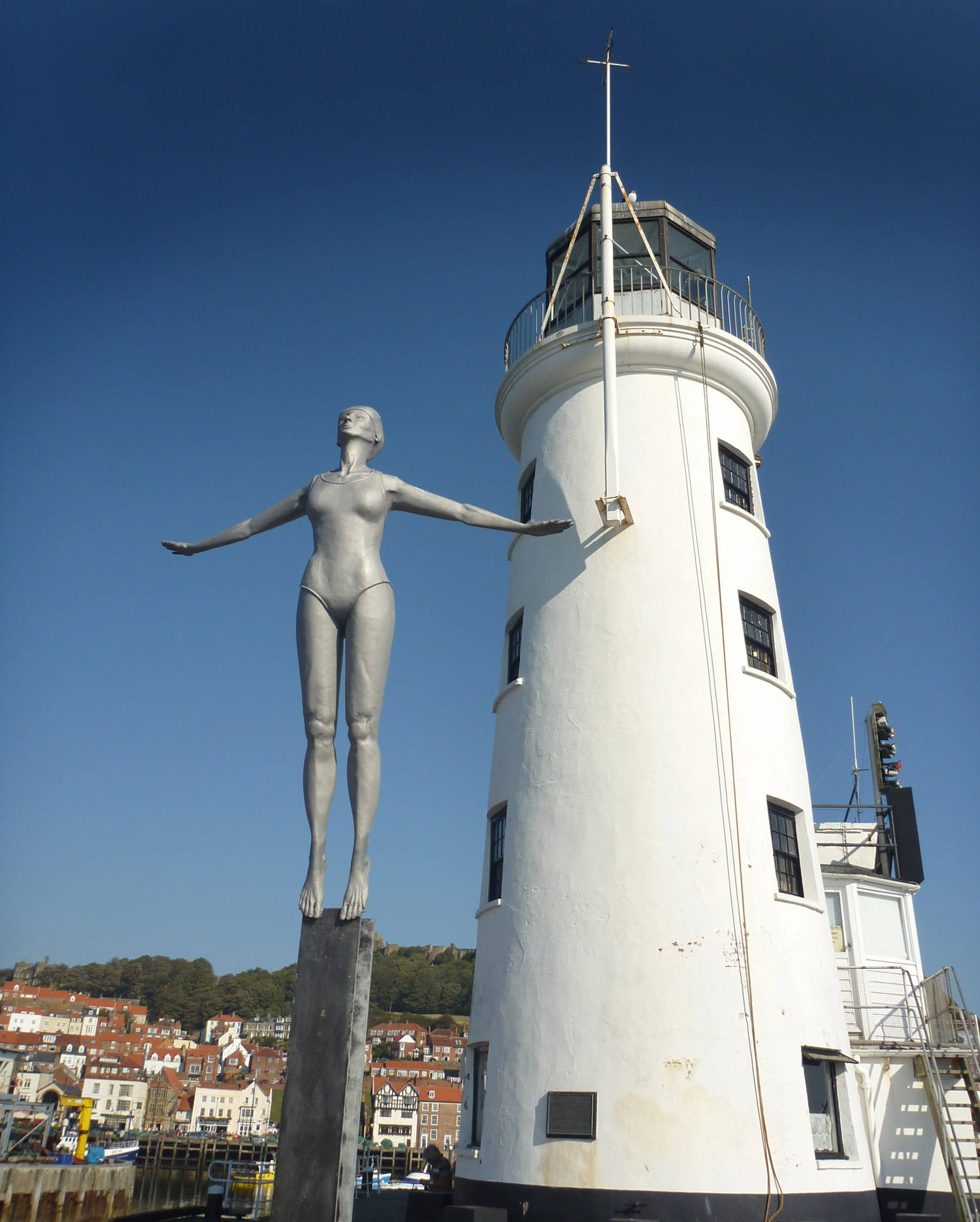 Scarborough Lighthouse and Lady Diver Statue |
 Alan McFaden |
Tuesday 18th of November 2014 03:26:19 PM |
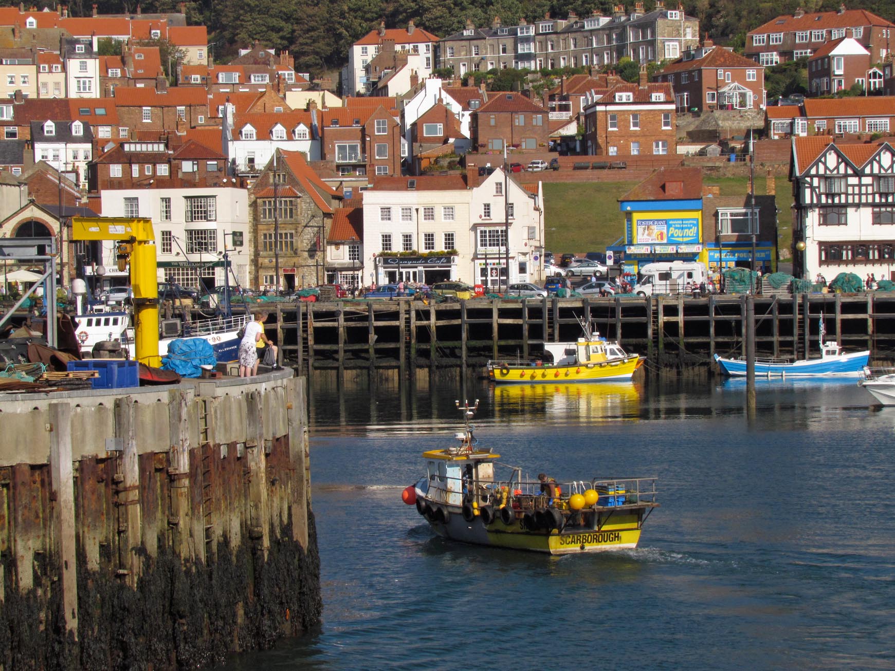
 Scarborough Fishermen's Dock |
Alan McFaden |
Tuesday 18th of November 2014 03:25:35 PM |
 Scarborough Harbour |
Alan McFaden |
Tuesday 18th of November 2014 03:25:03 PM |
 Scarborough |
Alan McFaden |
Tuesday 18th of November 2014 03:24:39 PM |
 Scarborough |
Alan McFaden |
Tuesday 18th of November 2014 03:24:08 PM |
 Scarborough Beach |
Alan McFaden |
Tuesday 18th of November 2014 03:23:49 PM |
 Scarborough Bay |
Alan McFaden |
Tuesday 18th of November 2014 03:23:18 PM |